Fankeng geodata
Fankeng (Fujian) is a seat of a fourth-order administrative division; located in China in Asia/Shanghai (GMT+8) time zone. In our database, there are 1268 cities with bigger population. Compared to other cities in China, 77.4% of cities are located further ↑North; 80.1% of cities are located further ←West and 78.4% of cities have lower elevation than Fankeng. Note1


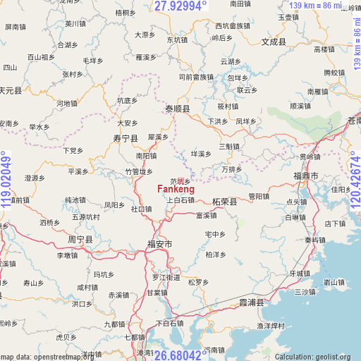
Fankeng GPS coordinates[2]
27° 18' 24.984" North, 119° 43' 24.996" East
| Map corner | latitude | longitude |
|---|---|---|
| Upper-left | 27.92994°, | 119.02049° |
| Center: | 27.30694°, | 119.72361° |
| Lower-right: | 26.68042°, | 120.42674° |
| Map W x H: | 138.9×138.9 km | = 86.3×86.3mi |
| max Lat: | 53.31946° ⇑77.4% North |
| Fankeng: | 27.30694° |
| min Lat: | ⇓22.6% South 18.22056° |
| min Long | Fankeng | max Long |
| 75.07348° | 119.72361° | 134.28917° |
| W 80.1%⇐ | ⇒19.9% E |
Elevation
Elevation of Fankeng is 629 m = 2064 ft, and this is 144.2 m = 473 ft above average elevation for this country.
| Max E: |
5622 m = 18445 ft | 21.6% |
| Fankeng | 629 m 2064 ft | |
| Avg. | 484.8 m = 1591 ft | |
Min E: |
-3 m = -10 ft | 78.4% |
See also: China elevation on elevation.city.
Geographical zone
Fankeng is located in North temperate zone (between Tropic of Cancer and the Arctic Circle). Distance of this Northern Tropic circle is 430.3 km =267.4 mi to South.| Distance of | km | miles | from Fankeng |
|---|---|---|---|
| North Pole | 6970.8 | 4331.5 | to North |
| Arctic Circle | 4364.9 | 2712.2 | to North |
| Tropic Cancer | 430.3 | 267.4 | to South |
| Equator | 3036.2 | 1886.6 | to South |


Nearby cities:
15 places around Fankeng: (largest is in red/bold)
• Fuxi
16.4 km =10.2 mi,  142°
142°
• Guihu
8.2 km =5.1 mi,  77°
77°
• Huangbai
14.7 km =9.1 mi,  155°
155°
• Nanyang
16.4 km =10.2 mi,  305°
305°
• Shangbaishi
7.1 km =4.4 mi,  179°
179°
• Shekou
18.4 km =11.4 mi,  234°
234°
• Shiyang
18.4 km =11.4 mi,  68°
68°
• Tantou
13 km =8.1 mi,  208°
208°
• Wuqu
17.6 km =10.9 mi,  242°
242°
• Xietan
19.1 km =11.9 mi,  275°
275°
• Yangxi
13.3 km =8.3 mi,  36°
36°
• Yingshan
8.2 km =5.1 mi,  108°
108°
• Zherong
18.5 km =11.5 mi, 113°
• Zhouling
13.9 km =8.6 mi,  5°
5°
• Zhuguanlong
16.3 km =10.1 mi, 283°
Sources, notices
• [Note1] Compared only with cities in China existing in our database
• [Src1] Map data: © OpenStreetMap contributors (CC-BY-SA)
• [Src2] Other city data from geonames.org with taken over terms of usage.
• [Src3] Geographical zone / Annual Mean Temperature by Robert A. Rohde @ Wikipedia
