Liulinzhou geodata
Liulinzhou (Hunan) is a seat of a third-order administrative division; located in China in Asia/Shanghai (GMT+8) time zone. In our database, there are 1268 cities with bigger population. Compared to other cities in China, 60.3% of cities are located further ↑North; 57.5% of cities are located further →East and 79.8% of cities have higher elevation than Liulinzhou. Note1


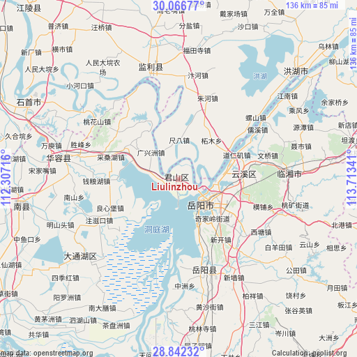
Liulinzhou GPS coordinates[2]
29° 27' 23.004" North, 113° 0' 37.008" East
| Map corner | latitude | longitude |
|---|---|---|
| Upper-left | 30.06677°, | 112.30716° |
| Center: | 29.45639°, | 113.01028° |
| Lower-right: | 28.84232°, | 113.71341° |
| Map W x H: | 136.1×136.1 km | = 84.6×84.6mi |
| max Lat: | 53.31946° ⇑60.3% North |
| Liulinzhou: | 29.45639° |
| min Lat: | ⇓39.7% South 18.22056° |
| min Long | Liulinzhou | max Long |
| 75.07348° | 113.01028° | 134.28917° |
| W 42.5%⇐ | ⇒57.5% E |
Elevation
Elevation of Liulinzhou is 27 m = 89 ft, and this is 457.8 m = 1502 ft below average elevation for this country.
| Max E: |
5622 m = 18445 ft | 79.8% |
| Avg. | 484.8 m = 1591 ft | |
| Liulinzhou | 27 m = 89 ft | |
Min E: |
-3 m = -10 ft | 20.2% |
See also: China elevation on elevation.city.
Geographical zone
Liulinzhou is located in North temperate zone (between Tropic of Cancer and the Arctic Circle). Distance of this Northern Tropic circle is 669.3 km =415.9 mi to South.| Distance of | km | miles | from Liulinzhou |
|---|---|---|---|
| North Pole | 6731.8 | 4182.9 | to North |
| Arctic Circle | 4125.9 | 2563.7 | to North |
| Tropic Cancer | 669.3 | 415.9 | to South |
| Equator | 3275.2 | 2035.1 | to South |


Nearby cities:
15 places around Liulinzhou: (largest is in red/bold)
• Bailuo
21.5 km =13.4 mi,  60°
60°
• Chiba
14.9 km =9.3 mi,  0°
0°
• Huage
38.4 km =23.9 mi,  242°
242°
• Lujiao
33.7 km =20.9 mi,  180°
180°
• Luoshan
37.6 km =23.4 mi,  51°
51°
• Qiaoshi
32.2 km =20 mi,  29°
29°
• Qipan
35.4 km =22 mi,  22°
22°
• Rongjiawan
35.2 km =21.9 mi,  165°
165°
• Sanzhou
12.2 km =7.6 mi,  327°
327°
• Taohuashan
38.2 km =23.7 mi,  305°
305°
• Tuanzhou
26.9 km =16.7 mi, 239°
• Yueyang
12.2 km =7.6 mi,  138°
138°
• Yunxi
22.9 km =14.2 mi,  85°
85°
• Zhemu
19.3 km =12 mi,  40°
40°
• Zhuhe
32.8 km =20.4 mi, 19°
Sources, notices
• [Note1] Compared only with cities in China existing in our database
• [Src1] Map data: © OpenStreetMap contributors (CC-BY-SA)
• [Src2] Other city data from geonames.org with taken over terms of usage.
• [Src3] Geographical zone / Annual Mean Temperature by Robert A. Rohde @ Wikipedia
