Xiquan geodata
Xiquan (Shaanxi) is a seat of a fourth-order administrative division; located in China in Asia/Shanghai (GMT+8) time zone. In our database, there are 1268 cities with bigger population. Compared to other cities in China, 72.2% of cities are located further ↓South; 75.7% of cities are located further →East and 67.7% of cities have lower elevation than Xiquan. Note1


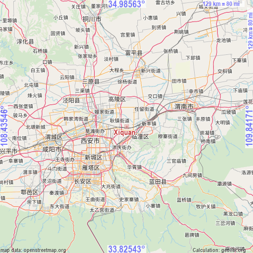
Xiquan GPS coordinates[2]
34° 24' 27.144" North, 109° 8' 18.888" East
| Map corner | latitude | longitude |
|---|---|---|
| Upper-left | 34.98563°, | 108.43546° |
| Center: | 34.40754°, | 109.13858° |
| Lower-right: | 33.82543°, | 109.84171° |
| Map W x H: | 129×129 km | = 80.2×80.2mi |
| max Lat: | 53.31946° ⇑27.8% North |
| Xiquan: | 34.40754° |
| min Lat: | ⇓72.2% South 18.22056° |
| min Long | Xiquan | max Long |
| 75.07348° | 109.13858° | 134.28917° |
| W 24.3%⇐ | ⇒75.7% E |
Elevation
Elevation of Xiquan is 371 m = 1217 ft, and this is 113.8 m = 373 ft below average elevation for this country.
| Max E: |
5622 m = 18445 ft | 32.3% |
| Avg. | 484.8 m = 1591 ft | |
| Xiquan | 371 m = 1217 ft | |
Min E: |
-3 m = -10 ft | 67.7% |
See also: China elevation on elevation.city.
Geographical zone
Xiquan is located in North temperate zone (between Tropic of Cancer and the Arctic Circle). Distance of this Northern Tropic circle is 1219.8 km =757.9 mi to South.| Distance of | km | miles | from Xiquan |
|---|---|---|---|
| North Pole | 6181.3 | 3840.9 | to North |
| Arctic Circle | 3575.4 | 2221.6 | to North |
| Tropic Cancer | 1219.8 | 757.9 | to South |
| Equator | 3825.8 | 2377.2 | to South |


Nearby cities:
15 places around Xiquan: (largest is in red/bold)
• Baqiao
11.2 km =7 mi,  207°
207°
• Daiwang
14.3 km =8.9 mi,  94°
94°
• Gengzhen
5 km =3.1 mi,  314°
314°
• Lintong
7.2 km =4.5 mi,  116°
116°
• Luyuan
15.1 km =9.4 mi,  341°
341°
• Qinling Jieban
10.4 km =6.5 mi,  102°
102°
• Renliu
12.3 km =7.6 mi,  41°
41°
• Xiekou
5.4 km =3.4 mi,  165°
165°
• Xinfeng
11.7 km =7.3 mi,  79°
79°
• Xingzhe
5.4 km =3.4 mi, 92°
• Xinhe
3.8 km =2.4 mi,  289°
289°
• Xinshi
15 km =9.3 mi,  14°
14°
• Xinzhu
8 km =5 mi,  251°
251°
• Yuchu
12.9 km =8 mi,  325°
325°
• Zhangbu
8.7 km =5.4 mi,  347°
347°
Sources, notices
• [Note1] Compared only with cities in China existing in our database
• [Src1] Map data: © OpenStreetMap contributors (CC-BY-SA)
• [Src2] Other city data from geonames.org with taken over terms of usage.
• [Src3] Geographical zone / Annual Mean Temperature by Robert A. Rohde @ Wikipedia
