Hancheng geodata
Hancheng (Shaanxi) is a seat of a fourth-order administrative division; located in China in Asia/Shanghai (GMT+8) time zone. In our database, there are 1268 cities with bigger population. Compared to other cities in China, 71.7% of cities are located further ↓South; 76.7% of cities are located further →East and 68% of cities have lower elevation than Hancheng. Note1


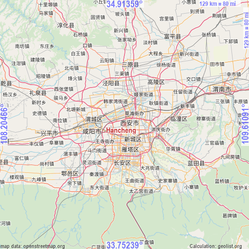
Hancheng GPS coordinates[2]
34° 20' 6" North, 108° 54' 28.008" East
| Map corner | latitude | longitude |
|---|---|---|
| Upper-left | 34.91359°, | 108.20466° |
| Center: | 34.335°, | 108.90778° |
| Lower-right: | 33.75239°, | 109.61091° |
| Map W x H: | 129.1×129.1 km | = 80.2×80.2mi |
| max Lat: | 53.31946° ⇑28.3% North |
| Hancheng: | 34.335° |
| min Lat: | ⇓71.7% South 18.22056° |
| min Long | Hancheng | max Long |
| 75.07348° | 108.90778° | 134.28917° |
| W 23.3%⇐ | ⇒76.7% E |
Elevation
Elevation of Hancheng is 377 m = 1237 ft, and this is 107.8 m = 354 ft below average elevation for this country.
| Max E: |
5622 m = 18445 ft | 32% |
| Avg. | 484.8 m = 1591 ft | |
| Hancheng | 377 m = 1237 ft | |
Min E: |
-3 m = -10 ft | 68% |
See also: China elevation on elevation.city.
Geographical zone
Hancheng is located in North temperate zone (between Tropic of Cancer and the Arctic Circle). Distance of this Northern Tropic circle is 1211.8 km =753 mi to South.| Distance of | km | miles | from Hancheng |
|---|---|---|---|
| North Pole | 6189.4 | 3845.9 | to North |
| Arctic Circle | 3583.5 | 2226.7 | to North |
| Tropic Cancer | 1211.8 | 753 | to South |
| Equator | 3817.7 | 2372.2 | to South |


Nearby cities:
15 places around Hancheng: (largest is in red/bold)
• Caotan
8.9 km =5.5 mi,  40°
40°
• Daminggong
6.1 km =3.8 mi,  123°
123°
• Lianhu
8.6 km =5.3 mi,  169°
169°
• Liucunbao
5.5 km =3.4 mi,  268°
268°
• Sanqiao
8.5 km =5.3 mi,  231°
231°
• Tanjia
5.5 km =3.4 mi,  93°
93°
• Weiyang
5.6 km =3.5 mi,  152°
152°
• Weiyanggong
5.1 km =3.2 mi,  177°
177°
• Xincheng
8.9 km =5.5 mi, 154°
• Xinjiamiao
8.1 km =5 mi,  113°
113°
• Xi’an
8.7 km =5.4 mi, 167°
• Xujia
5.1 km =3.2 mi,  83°
83°
• Yaodian
9.6 km =6 mi,  327°
327°
• Zhangjiabao
2.8 km =1.7 mi,  103°
103°
• Zhengyang
9.9 km =6.2 mi,  7°
7°
Sources, notices
• [Note1] Compared only with cities in China existing in our database
• [Src1] Map data: © OpenStreetMap contributors (CC-BY-SA)
• [Src2] Other city data from geonames.org with taken over terms of usage.
• [Src3] Geographical zone / Annual Mean Temperature by Robert A. Rohde @ Wikipedia
