Xincheng geodata
Xincheng (Shaanxi) is a seat of a third-order administrative division; located in China in Asia/Shanghai (GMT+8) time zone. In our database, there are 1268 cities with bigger population. Compared to other cities in China, 71.4% of cities are located further ↓South; 76.5% of cities are located further →East and 70% of cities have lower elevation than Xincheng. Note1


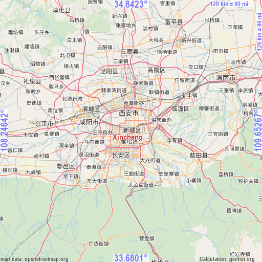
Xincheng GPS coordinates[2]
34° 15' 47.556" North, 108° 56' 58.344" East
| Map corner | latitude | longitude |
|---|---|---|
| Upper-left | 34.8423°, | 108.24642° |
| Center: | 34.26321°, | 108.94954° |
| Lower-right: | 33.6801°, | 109.65267° |
| Map W x H: | 129.2×129.2 km | = 80.3×80.3mi |
| max Lat: | 53.31946° ⇑28.6% North |
| Xincheng: | 34.26321° |
| min Lat: | ⇓71.4% South 18.22056° |
| min Long | Xincheng | max Long |
| 75.07348° | 108.94954° | 134.28917° |
| W 23.5%⇐ | ⇒76.5% E |
Elevation
Elevation of Xincheng is 412 m = 1352 ft, and this is 72.8 m = 239 ft below average elevation for this country.
| Max E: |
5622 m = 18445 ft | 30% |
| Avg. | 484.8 m = 1591 ft | |
| Xincheng | 412 m = 1352 ft | |
Min E: |
-3 m = -10 ft | 70% |
See also: China elevation on elevation.city.
Geographical zone
Xincheng is located in North temperate zone (between Tropic of Cancer and the Arctic Circle). Distance of this Northern Tropic circle is 1203.8 km =748 mi to South.| Distance of | km | miles | from Xincheng |
|---|---|---|---|
| North Pole | 6197.4 | 3850.9 | to North |
| Arctic Circle | 3591.5 | 2231.7 | to North |
| Tropic Cancer | 1203.8 | 748 | to South |
| Equator | 3809.7 | 2367.2 | to South |


Nearby cities:
15 places around Xincheng: (largest is in red/bold)
• Beilin
5 km =3.1 mi,  218°
218°
• Changyanbao
7.7 km =4.8 mi,  179°
179°
• Daminggong
4.8 km =3 mi,  15°
15°
• Dengjiapo
8 km =5 mi,  119°
119°
• Lianhu
2.4 km =1.5 mi,  257°
257°
• Qujiang
8.6 km =5.3 mi,  155°
155°
• Tanjia
7.9 km =4.9 mi,  12°
12°
• Weiyang
3.3 km =2.1 mi,  337°
337°
• Weiyanggong
4.6 km =2.9 mi,  309°
309°
• Xinjiamiao
5.9 km =3.7 mi,  37°
37°
• Xi’an
2 km =1.2 mi,  254°
254°
• Xujia
8.6 km =5.3 mi, 7°
• Yanta
6.3 km =3.9 mi, 177°
• Zhangbagou
8.5 km =5.3 mi,  228°
228°
• Zhangjiabao
7.4 km =4.6 mi,  351°
351°
Sources, notices
• [Note1] Compared only with cities in China existing in our database
• [Src1] Map data: © OpenStreetMap contributors (CC-BY-SA)
• [Src2] Other city data from geonames.org with taken over terms of usage.
• [Src3] Geographical zone / Annual Mean Temperature by Robert A. Rohde @ Wikipedia
