Qingshiling geodata
Qingshiling (Liaoning) is a seat of a fourth-order administrative division; located in China in Asia/Shanghai (GMT+8) time zone. In our database, there are 1268 cities with bigger population. Compared to other cities in China, 88% of cities are located further ↓South; 91.9% of cities are located further ←West and 83.9% of cities have higher elevation than Qingshiling. Note1


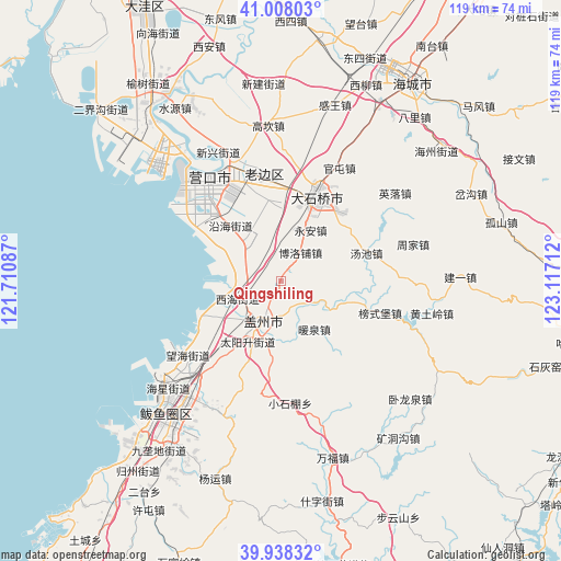
Qingshiling GPS coordinates[2]
40° 28' 31.116" North, 122° 24' 50.364" East
| Map corner | latitude | longitude |
|---|---|---|
| Upper-left | 41.00803°, | 121.71087° |
| Center: | 40.47531°, | 122.41399° |
| Lower-right: | 39.93832°, | 123.11712° |
| Map W x H: | 118.9×118.9 km | = 73.9×73.9mi |
| max Lat: | 53.31946° ⇑12% North |
| Qingshiling: | 40.47531° |
| min Lat: | ⇓88% South 18.22056° |
| min Long | Qingshiling | max Long |
| 75.07348° | 122.41399° | 134.28917° |
| W 91.9%⇐ | ⇒8.1% E |
Elevation
Elevation of Qingshiling is 18 m = 59 ft, and this is 466.8 m = 1531 ft below average elevation for this country.
| Max E: |
5622 m = 18445 ft | 83.9% |
| Avg. | 484.8 m = 1591 ft | |
| Qingshiling | 18 m = 59 ft | |
Min E: |
-3 m = -10 ft | 16.1% |
See also: China elevation on elevation.city.
Geographical zone
Qingshiling is located in North temperate zone (between Tropic of Cancer and the Arctic Circle). Distance of this Northern Tropic circle is 1894.5 km =1177.2 mi to South.| Distance of | km | miles | from Qingshiling |
|---|---|---|---|
| North Pole | 5506.6 | 3421.6 | to North |
| Arctic Circle | 2900.7 | 1802.4 | to North |
| Tropic Cancer | 1894.5 | 1177.2 | to South |
| Equator | 4500.4 | 2796.4 | to South |


Nearby cities:
15 places around Qingshiling: (largest is in red/bold)
• Boluopu
7.1 km =4.4 mi,  32°
32°
• Dongcheng
8.6 km =5.3 mi,  204°
204°
• Erdao
18.3 km =11.4 mi,  317°
317°
• Gaizhou
9.8 km =6.1 mi, 203°
• Gaotun
16.6 km =10.3 mi,  106°
106°
• Gulou
9.6 km =6 mi,  207°
207°
• Jinqiao
18.4 km =11.4 mi,  18°
18°
• Liushu
15.3 km =9.5 mi,  0°
0°
• Nuanquan
12.9 km =8 mi,  144°
144°
• Taiyangsheng
12.5 km =7.8 mi, 201°
• Tuandian
6.5 km =4 mi, 136°
• Tuanshan
14.1 km =8.8 mi,  231°
231°
• Xihai
9.7 km =6 mi,  241°
241°
• Xutun
14.8 km =9.2 mi,  188°
188°
• Yong’an
12.5 km =7.8 mi, 31°
Sources, notices
• [Note1] Compared only with cities in China existing in our database
• [Src1] Map data: © OpenStreetMap contributors (CC-BY-SA)
• [Src2] Other city data from geonames.org with taken over terms of usage.
• [Src3] Geographical zone / Annual Mean Temperature by Robert A. Rohde @ Wikipedia
