Nanfaxin geodata
Nanfaxin (Beijing) is a seat of a fourth-order administrative division; located in China in Asia/Shanghai (GMT+8) time zone. In our database, there are 1268 cities with bigger population. Compared to other cities in China, 86.8% of cities are located further ↓South; 63.7% of cities are located further ←West and 75.3% of cities have higher elevation than Nanfaxin. Note1


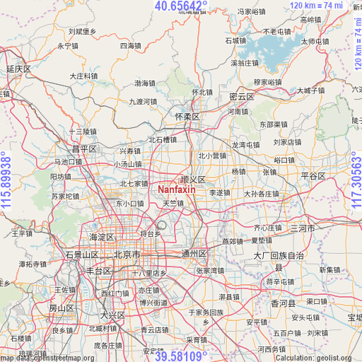
Nanfaxin GPS coordinates[2]
40° 7' 15.168" North, 116° 36' 9" East
| Map corner | latitude | longitude |
|---|---|---|
| Upper-left | 40.65642°, | 115.89938° |
| Center: | 40.12088°, | 116.6025° |
| Lower-right: | 39.58109°, | 117.30563° |
| Map W x H: | 119.6×119.6 km | = 74.3×74.3mi |
| max Lat: | 53.31946° ⇑13.2% North |
| Nanfaxin: | 40.12088° |
| min Lat: | ⇓86.8% South 18.22056° |
| min Long | Nanfaxin | max Long |
| 75.07348° | 116.6025° | 134.28917° |
| W 63.7%⇐ | ⇒36.3% E |
Elevation
Elevation of Nanfaxin is 36 m = 118 ft, and this is 448.8 m = 1472 ft below average elevation for this country.
| Max E: |
5622 m = 18445 ft | 75.3% |
| Avg. | 484.8 m = 1591 ft | |
| Nanfaxin | 36 m = 118 ft | |
Min E: |
-3 m = -10 ft | 24.7% |
See also: China elevation on elevation.city.
Geographical zone
Nanfaxin is located in North temperate zone (between Tropic of Cancer and the Arctic Circle). Distance of this Northern Tropic circle is 1855.1 km =1152.7 mi to South.| Distance of | km | miles | from Nanfaxin |
|---|---|---|---|
| North Pole | 5546 | 3446.1 | to North |
| Arctic Circle | 2940.2 | 1827 | to North |
| Tropic Cancer | 1855.1 | 1152.7 | to South |
| Equator | 4461 | 2771.9 | to South |


Nearby cities:
15 places around Nanfaxin: (largest is in red/bold)
• Beiqijia
15.8 km =9.8 mi,  268°
268°
• Beishicao
15.6 km =9.7 mi,  334°
334°
• Beixiaoying
13.2 km =8.2 mi,  49°
49°
• Gaoliying
10.6 km =6.6 mi,  301°
301°
• Jinzhan
13.1 km =8.1 mi,  191°
191°
• Laiguangying
17.9 km =11.1 mi,  233°
233°
• Liqiao
7.1 km =4.4 mi,  158°
158°
• Lisui
13.1 km =8.1 mi,  106°
106°
• Nancai
8.1 km =5 mi,  77°
77°
• Niulanshan
11.4 km =7.1 mi,  22°
22°
• Shengli
3.5 km =2.2 mi,  94°
94°
• Shunyi
3.9 km =2.4 mi, 88°
• Sunhe
11 km =6.8 mi,  218°
218°
• Tianzhu
7.4 km =4.6 mi,  198°
198°
• Ximapo
6.4 km =4 mi,  37°
37°
Sources, notices
• [Note1] Compared only with cities in China existing in our database
• [Src1] Map data: © OpenStreetMap contributors (CC-BY-SA)
• [Src2] Other city data from geonames.org with taken over terms of usage.
• [Src3] Geographical zone / Annual Mean Temperature by Robert A. Rohde @ Wikipedia
