Mudanjiang geodata
Mudanjiang (Heilongjiang) is a seat of a second-order administrative division; located in China in Asia/Shanghai (GMT+8) time zone. With population of 665,915 people, there are 97 cities with bigger population in this country. Compared to other cities in China, 93.5% of cities are located further ↓South; 98.8% of cities are located further ←West and 58.6% of cities have lower elevation than Mudanjiang. Note1


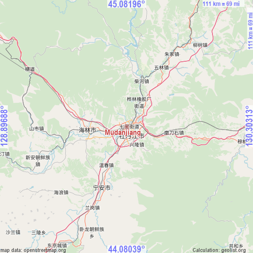
Mudanjiang GPS coordinates[2]
44° 34' 59.988" North, 129° 36' 0" East
| Map corner | latitude | longitude |
|---|---|---|
| Upper-left | 45.08196°, | 128.89688° |
| Center: | 44.58333°, | 129.6° |
| Lower-right: | 44.08039°, | 130.30313° |
| Map W x H: | 111.4×111.4 km | = 69.2×69.2mi |
| max Lat: | 53.31946° ⇑6.5% North |
| Mudanjiang: | 44.58333° |
| min Lat: | ⇓93.5% South 18.22056° |
| min Long | Mudanjiang | max Long |
| 75.07348° | 129.6° | 134.28917° |
| W 98.8%⇐ | ⇒1.2% E |
Elevation
Elevation of Mudanjiang is 242 m = 794 ft, and this is 242.8 m = 797 ft below average elevation for this country.
| Max E: |
5622 m = 18445 ft | 41.4% |
| Avg. | 484.8 m = 1591 ft | |
| Mudanjiang | 242 m = 794 ft | |
Min E: |
-3 m = -10 ft | 58.6% |
See also: Mudanjiang elevation on elevation.city.
Geographical zone
Mudanjiang is located in North temperate zone (between Tropic of Cancer and the Arctic Circle). Distance of this Northern Tropic circle is 2351.3 km =1461 mi to South.| Distance of | km | miles | from Mudanjiang |
|---|---|---|---|
| North Pole | 5049.9 | 3137.9 | to North |
| Arctic Circle | 2444 | 1518.6 | to North |
| Tropic Cancer | 2351.3 | 1461 | to South |
| Equator | 4957.2 | 3080.3 | to South |


Nearby cities:
15 places around Mudanjiang: (largest is in red/bold)
• Bei’an
5.1 km =3.2 mi,  339°
339°
• Chaihe
20.6 km =12.8 mi,  17°
17°
• Fanjia
25 km =15.5 mi,  204°
204°
• Hailin
17 km =10.6 mi,  265°
265°
• Hainan
8.9 km =5.5 mi,  255°
255°
• Hualin
12.6 km =7.8 mi,  28°
28°
• Modaoshi
20.7 km =12.9 mi,  97°
97°
• Tieling
6.2 km =3.9 mi,  81°
81°
• Wenchun
19.2 km =11.9 mi,  207°
207°
• Xianfeng
0.9 km =0.6 mi,  167°
167°
• Xiangyang
1.7 km =1.1 mi,  287°
287°
• Xinglong
4.8 km =3 mi,  178°
178°
• Xin’an
2.1 km =1.3 mi, 99°
• Yangming
2.2 km =1.4 mi,  48°
48°
• Yanjiang
2.6 km =1.6 mi,  223°
223°
Sources, notices
• [Note1] Compared only with cities in China existing in our database
• [Src1] Map data: © OpenStreetMap contributors (CC-BY-SA)
• [Src2] Other city data from geonames.org with taken over terms of usage.
• [Src3] Geographical zone / Annual Mean Temperature by Robert A. Rohde @ Wikipedia
