Hunchun geodata
Hunchun (Jilin) is a seat of a third-order administrative division; located in China in Asia/Shanghai (GMT+8) time zone. With population of 77,028 people, there are 557 cities with bigger population in this country. Compared to other cities in China, 91.8% of cities are located further ↓South; 99.4% of cities are located further ←West and 73% of cities have higher elevation than Hunchun. Note1


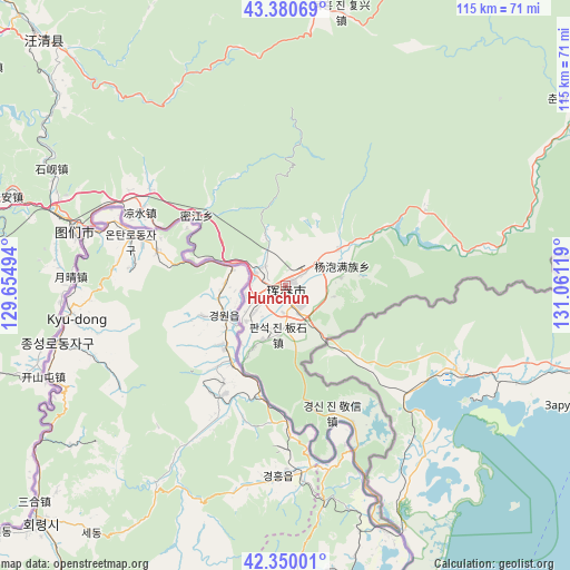
Hunchun GPS coordinates[2]
42° 52' 3" North, 130° 21' 29.016" East
| Map corner | latitude | longitude |
|---|---|---|
| Upper-left | 43.38069°, | 129.65494° |
| Center: | 42.8675°, | 130.35806° |
| Lower-right: | 42.35001°, | 131.06119° |
| Map W x H: | 114.6×114.6 km | = 71.2×71.2mi |
| max Lat: | 53.31946° ⇑8.2% North |
| Hunchun: | 42.8675° |
| min Lat: | ⇓91.8% South 18.22056° |
| min Long | Hunchun | max Long |
| 75.07348° | 130.35806° | 134.28917° |
| W 99.4%⇐ | ⇒0.59999999999999% E |
Elevation
Elevation of Hunchun is 42 m = 138 ft, and this is 442.8 m = 1453 ft below average elevation for this country.
| Max E: |
5622 m = 18445 ft | 73% |
| Avg. | 484.8 m = 1591 ft | |
| Hunchun | 42 m = 138 ft | |
Min E: |
-3 m = -10 ft | 27% |
See also: Hunchun elevation on elevation.city.
Geographical zone
Hunchun is located in North temperate zone (between Tropic of Cancer and the Arctic Circle). Distance of this Northern Tropic circle is 2160.5 km =1342.5 mi to South.| Distance of | km | miles | from Hunchun |
|---|---|---|---|
| North Pole | 5240.6 | 3256.4 | to North |
| Arctic Circle | 2634.8 | 1637.2 | to North |
| Tropic Cancer | 2160.5 | 1342.5 | to South |
| Equator | 4766.4 | 2961.7 | to South |


Nearby cities:
15 places around Hunchun: (largest is in red/bold)
• Banshi
10 km =6.2 mi,  189°
189°
• Chang’an
58.9 km =36.6 mi,  287°
287°
• Chongmin
63.8 km =39.6 mi,  255°
255°
• Dongguang
65 km =40.4 mi,  316°
316°
• Erdaopaozi
27.2 km =16.9 mi,  160°
160°
• Jincang
56 km =34.8 mi,  10°
10°
• Kaishantun
52.4 km =32.6 mi,  249°
249°
• Machuanzi
3.2 km =2 mi,  101°
101°
• Mijiang
22.7 km =14.1 mi,  308°
308°
• Sanjiazi
5.3 km =3.3 mi,  234°
234°
• Shixian
53.8 km =33.4 mi,  296°
296°
• Tumen
43.4 km =27 mi,  284°
284°
• Yangmulinzi
11.9 km =7.4 mi,  71°
71°
• Ying’an
6.4 km =4 mi, 293°
• Zhongxin
12.6 km =7.8 mi,  56°
56°
Sources, notices
• [Note1] Compared only with cities in China existing in our database
• [Src1] Map data: © OpenStreetMap contributors (CC-BY-SA)
• [Src2] Other city data from geonames.org with taken over terms of usage.
• [Src3] Geographical zone / Annual Mean Temperature by Robert A. Rohde @ Wikipedia
