Henanzhai geodata
Henanzhai (Beijing) is a seat of a fourth-order administrative division; located in China in Asia/Shanghai (GMT+8) time zone. In our database, there are 1268 cities with bigger population. Compared to other cities in China, 87.6% of cities are located further ↓South; 65.1% of cities are located further ←West and 66.6% of cities have higher elevation than Henanzhai. Note1


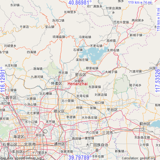
Henanzhai GPS coordinates[2]
40° 20' 9.528" North, 116° 49' 55.668" East
| Map corner | latitude | longitude |
|---|---|---|
| Upper-left | 40.86981°, | 116.12901° |
| Center: | 40.33598°, | 116.83213° |
| Lower-right: | 39.79789°, | 117.53526° |
| Map W x H: | 119.2×119.2 km | = 74.1×74.1mi |
| max Lat: | 53.31946° ⇑12.4% North |
| Henanzhai: | 40.33598° |
| min Lat: | ⇓87.6% South 18.22056° |
| min Long | Henanzhai | max Long |
| 75.07348° | 116.83213° | 134.28917° |
| W 65.1%⇐ | ⇒34.9% E |
Elevation
Elevation of Henanzhai is 66 m = 217 ft, and this is 418.8 m = 1374 ft below average elevation for this country.
| Max E: |
5622 m = 18445 ft | 66.6% |
| Avg. | 484.8 m = 1591 ft | |
| Henanzhai | 66 m = 217 ft | |
Min E: |
-3 m = -10 ft | 33.4% |
See also: China elevation on elevation.city.
Geographical zone
Henanzhai is located in North temperate zone (between Tropic of Cancer and the Arctic Circle). Distance of this Northern Tropic circle is 1879 km =1167.6 mi to South.| Distance of | km | miles | from Henanzhai |
|---|---|---|---|
| North Pole | 5522.1 | 3431.3 | to North |
| Arctic Circle | 2916.2 | 1812 | to North |
| Tropic Cancer | 1879 | 1167.6 | to South |
| Equator | 4484.9 | 2786.8 | to South |


Nearby cities:
15 places around Henanzhai: (largest is in red/bold)
• Beifang
12.4 km =7.7 mi,  263°
263°
• Beixiaoying
18.1 km =11.2 mi,  211°
211°
• Dongshaoqu
11.8 km =7.3 mi,  115°
115°
• Gulou
3.8 km =2.4 mi,  1°
1°
• Huaibei
13.2 km =8.2 mi,  298°
298°
• Jugezhuang
11 km =6.8 mi,  66°
66°
• Longshan
17.3 km =10.7 mi, 264°
• Longwantun
12.8 km =8 mi,  170°
170°
• Miaocheng
18.4 km =11.4 mi,  254°
254°
• Mulin
11.2 km =7 mi,  202°
202°
• Shilibu
4 km =2.5 mi,  309°
309°
• Xitiangezhuang
9.4 km =5.8 mi,  323°
323°
• Xiwengzhuang
14.9 km =9.3 mi, 2°
• Yangsong
13.9 km =8.6 mi, 250°
• Yanqi
15.2 km =9.4 mi,  280°
280°
Sources, notices
• [Note1] Compared only with cities in China existing in our database
• [Src1] Map data: © OpenStreetMap contributors (CC-BY-SA)
• [Src2] Other city data from geonames.org with taken over terms of usage.
• [Src3] Geographical zone / Annual Mean Temperature by Robert A. Rohde @ Wikipedia
