Chunhe geodata
Chunhe (Yunnan) is a seat of a fourth-order administrative division; located in China in Asia/Shanghai (GMT+8) time zone. In our database, there are 1268 cities with bigger population. Compared to other cities in China, 88.8% of cities are located further ↑North; 92.3% of cities are located further →East and 92.5% of cities have lower elevation than Chunhe. Note1


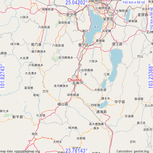
Chunhe GPS coordinates[2]
24° 24' 12.06" North, 102° 31' 49.98" East
| Map corner | latitude | longitude |
|---|---|---|
| Upper-left | 25.04202°, | 101.82743° |
| Center: | 24.40335°, | 102.53055° |
| Lower-right: | 23.76143°, | 103.23368° |
| Map W x H: | 142.4×142.4 km | = 88.5×88.5mi |
| max Lat: | 53.31946° ⇑88.8% North |
| Chunhe: | 24.40335° |
| min Lat: | ⇓11.2% South 18.22056° |
| min Long | Chunhe | max Long |
| 75.07348° | 102.53055° | 134.28917° |
| W 7.7%⇐ | ⇒92.3% E |
Elevation
Elevation of Chunhe is 1638 m = 5374 ft, and this is 1153.2 m = 3783 ft above average elevation for this country.
| Max E: |
5622 m = 18445 ft | 7.5% |
| Chunhe | 1638 m 5374 ft | |
| Avg. | 484.8 m = 1591 ft | |
Min E: |
-3 m = -10 ft | 92.5% |
See also: China elevation on elevation.city.
Geographical zone
Chunhe is located in North temperate zone (between Tropic of Cancer and the Arctic Circle). Distance of this Northern Tropic circle is 107.5 km =66.8 mi to South.| Distance of | km | miles | from Chunhe |
|---|---|---|---|
| North Pole | 7293.7 | 4532.1 | to North |
| Arctic Circle | 4687.8 | 2912.9 | to North |
| Tropic Cancer | 107.5 | 66.8 | to South |
| Equator | 2713.4 | 1686 | to South |


Nearby cities:
15 places around Chunhe: (largest is in red/bold)
• Anhua Daying
14.5 km =9 mi,  83°
83°
• Beicheng
3.2 km =2 mi,  34°
34°
• Dayingjie
8 km =5 mi,  206°
206°
• Dayingjie
15.4 km =9.6 mi,  134°
134°
• Gaocang
9.1 km =5.7 mi,  185°
185°
• Liqi
2.7 km =1.7 mi, 127°
• Liujie
21.6 km =13.4 mi,  46°
46°
• Luohe
16.5 km =10.3 mi,  240°
240°
• Qianwei
21.2 km =13.2 mi,  108°
108°
• Shangfang Xinjie
16.9 km =10.5 mi,  7°
7°
• Shuanghejie
20.5 km =12.7 mi,  332°
332°
• Xiaoshiqiao
10 km =6.2 mi,  61°
61°
• Xiyang
25.2 km =15.7 mi,  285°
285°
• Yanhe
16.5 km =10.3 mi, 192°
• Yuxi
5.5 km =3.4 mi,  167°
167°
Sources, notices
• [Note1] Compared only with cities in China existing in our database
• [Src1] Map data: © OpenStreetMap contributors (CC-BY-SA)
• [Src2] Other city data from geonames.org with taken over terms of usage.
• [Src3] Geographical zone / Annual Mean Temperature by Robert A. Rohde @ Wikipedia
