Chengjiao geodata
Chengjiao (Henan) is a seat of a fourth-order administrative division; located in China in Asia/Shanghai (GMT+8) time zone. In our database, there are 1268 cities with bigger population. Compared to other cities in China, 66.3% of cities are located further ↓South; 61.4% of cities are located further →East and 53.3% of cities have lower elevation than Chengjiao. Note1


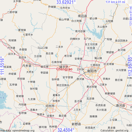
Chengjiao GPS coordinates[2]
33° 2' 30.408" North, 112° 15' 16.992" East
| Map corner | latitude | longitude |
|---|---|---|
| Upper-left | 33.62921°, | 111.5516° |
| Center: | 33.04178°, | 112.25472° |
| Lower-right: | 32.4504°, | 112.95785° |
| Map W x H: | 131.1×131.1 km | = 81.5×81.5mi |
| max Lat: | 53.31946° ⇑33.7% North |
| Chengjiao: | 33.04178° |
| min Lat: | ⇓66.3% South 18.22056° |
| min Long | Chengjiao | max Long |
| 75.07348° | 112.25472° | 134.28917° |
| W 38.6%⇐ | ⇒61.4% E |
Elevation
Elevation of Chengjiao is 191 m = 627 ft, and this is 293.8 m = 964 ft below average elevation for this country.
| Max E: |
5622 m = 18445 ft | 46.7% |
| Avg. | 484.8 m = 1591 ft | |
| Chengjiao | 191 m = 627 ft | |
Min E: |
-3 m = -10 ft | 53.3% |
See also: China elevation on elevation.city.
Geographical zone
Chengjiao is located in North temperate zone (between Tropic of Cancer and the Arctic Circle). Distance of this Northern Tropic circle is 1068 km =663.6 mi to South.| Distance of | km | miles | from Chengjiao |
|---|---|---|---|
| North Pole | 6333.2 | 3935.3 | to North |
| Arctic Circle | 3727.3 | 2316 | to North |
| Tropic Cancer | 1068 | 663.6 | to South |
| Equator | 3673.9 | 2282.9 | to South |


Nearby cities:
15 places around Chengjiao: (largest is in red/bold)
• Angao
14.6 km =9.1 mi,  55°
55°
• Chaobei
14.1 km =8.8 mi,  269°
269°
• Erlong
20.8 km =12.9 mi,  341°
341°
• Gaoqiu
21.1 km =13.1 mi,  308°
308°
• Laozhuang
10.8 km =6.7 mi,  12°
12°
• Liuquan
7.5 km =4.7 mi,  85°
85°
• Luyi
20.4 km =12.7 mi,  288°
288°
• Qutun
21.4 km =13.3 mi, 269°
• Shifosi
10.1 km =6.3 mi, 294°
• Wangcun
14.9 km =9.3 mi,  100°
100°
• Wanggang
17 km =10.6 mi, 292°
• Xiezhuang
20.7 km =12.9 mi,  54°
54°
• Yangying
9.3 km =5.8 mi,  241°
241°
• Zhenping Chengguanzhen
2.2 km =1.4 mi, 244°
• Zheshan
9 km =5.6 mi, 87°
Sources, notices
• [Note1] Compared only with cities in China existing in our database
• [Src1] Map data: © OpenStreetMap contributors (CC-BY-SA)
• [Src2] Other city data from geonames.org with taken over terms of usage.
• [Src3] Geographical zone / Annual Mean Temperature by Robert A. Rohde @ Wikipedia
