Zhongpai geodata
Zhongpai (Gansu) is a seat of a fourth-order administrative division; located in China in Asia/Shanghai (GMT+8) time zone. In our database, there are 1268 cities with bigger population. Compared to other cities in China, 68.9% of cities are located further ↓South; 89.7% of cities are located further →East and 94.3% of cities have lower elevation than Zhongpai. Note1


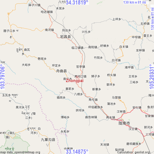
Zhongpai GPS coordinates[2]
33° 44' 7.656" North, 104° 30' 0.648" East
| Map corner | latitude | longitude |
|---|---|---|
| Upper-left | 34.31819°, | 103.79706° |
| Center: | 33.73546°, | 104.50018° |
| Lower-right: | 33.14875°, | 105.20331° |
| Map W x H: | 130×130 km | = 80.8×80.8mi |
| max Lat: | 53.31946° ⇑31.1% North |
| Zhongpai: | 33.73546° |
| min Lat: | ⇓68.9% South 18.22056° |
| min Long | Zhongpai | max Long |
| 75.07348° | 104.50018° | 134.28917° |
| W 10.3%⇐ | ⇒89.7% E |
Elevation
Elevation of Zhongpai is 1904 m = 6247 ft, and this is 1419.2 m = 4656 ft above average elevation for this country.
| Max E: |
5622 m = 18445 ft | 5.7% |
| Zhongpai | 1904 m 6247 ft | |
| Avg. | 484.8 m = 1591 ft | |
Min E: |
-3 m = -10 ft | 94.3% |
See also: China elevation on elevation.city.
Geographical zone
Zhongpai is located in North temperate zone (between Tropic of Cancer and the Arctic Circle). Distance of this Northern Tropic circle is 1145.1 km =711.5 mi to South.| Distance of | km | miles | from Zhongpai |
|---|---|---|---|
| North Pole | 6256 | 3887.3 | to North |
| Arctic Circle | 3650.1 | 2268.1 | to North |
| Tropic Cancer | 1145.1 | 711.5 | to South |
| Equator | 3751 | 2330.8 | to South |


Nearby cities:
15 places around Zhongpai: (largest is in red/bold)
• Baleng
14.3 km =8.9 mi,  175°
175°
• Chigan
12 km =7.5 mi,  203°
203°
• Dachuan
6.3 km =3.9 mi,  250°
250°
• Gongzishi
6.6 km =4.1 mi,  292°
292°
• Guanting
9.5 km =5.9 mi,  18°
18°
• Huama
3.7 km =2.3 mi,  87°
87°
• Jiangpan
13.4 km =8.3 mi, 290°
• Nanyu
8.3 km =5.2 mi,  256°
256°
• Sanjiaoping
11.5 km =7.1 mi,  213°
213°
• Shawan
13.4 km =8.3 mi,  153°
153°
• Shizi
16.7 km =10.4 mi, 86°
• Taiyu
6.6 km =4.1 mi,  26°
26°
• Wuping
19.3 km =12 mi,  231°
231°
• Xinzhai
19.8 km =12.3 mi,  120°
120°
• Zhouqu Chengguanzhen
13.8 km =8.6 mi, 293°
Sources, notices
• [Note1] Compared only with cities in China existing in our database
• [Src1] Map data: © OpenStreetMap contributors (CC-BY-SA)
• [Src2] Other city data from geonames.org with taken over terms of usage.
• [Src3] Geographical zone / Annual Mean Temperature by Robert A. Rohde @ Wikipedia
