Donghuanggou geodata
Donghuanggou (Shaanxi) is a seat of a fourth-order administrative division; located in China in Asia/Shanghai (GMT+8) time zone. In our database, there are 1268 cities with bigger population. Compared to other cities in China, 66.6% of cities are located further ↓South; 86% of cities are located further →East and 86.5% of cities have lower elevation than Donghuanggou. Note1


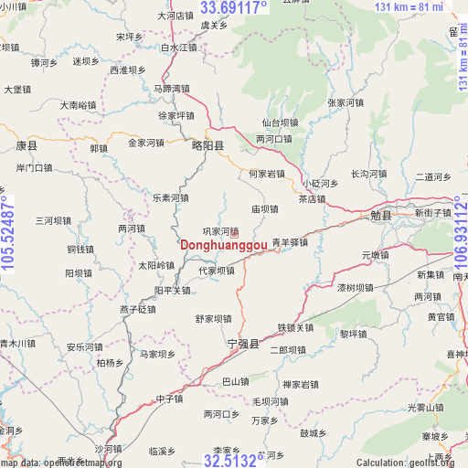
Donghuanggou GPS coordinates[2]
33° 6' 14.976" North, 106° 13' 40.764" East
| Map corner | latitude | longitude |
|---|---|---|
| Upper-left | 33.69117°, | 105.52487° |
| Center: | 33.10416°, | 106.22799° |
| Lower-right: | 32.5132°, | 106.93112° |
| Map W x H: | 131×131 km | = 81.4×81.4mi |
| max Lat: | 53.31946° ⇑33.4% North |
| Donghuanggou: | 33.10416° |
| min Lat: | ⇓66.6% South 18.22056° |
| min Long | Donghuanggou | max Long |
| 75.07348° | 106.22799° | 134.28917° |
| W 14%⇐ | ⇒86% E |
Elevation
Elevation of Donghuanggou is 1079 m = 3540 ft, and this is 594.2 m = 1949 ft above average elevation for this country.
| Max E: |
5622 m = 18445 ft | 13.5% |
| Donghuanggou | 1079 m 3540 ft | |
| Avg. | 484.8 m = 1591 ft | |
Min E: |
-3 m = -10 ft | 86.5% |
See also: China elevation on elevation.city.
Geographical zone
Donghuanggou is located in North temperate zone (between Tropic of Cancer and the Arctic Circle). Distance of this Northern Tropic circle is 1074.9 km =667.9 mi to South.| Distance of | km | miles | from Donghuanggou |
|---|---|---|---|
| North Pole | 6326.2 | 3930.9 | to North |
| Arctic Circle | 3720.3 | 2311.7 | to North |
| Tropic Cancer | 1074.9 | 667.9 | to South |
| Equator | 3680.8 | 2287.1 | to South |


Nearby cities:
15 places around Donghuanggou: (largest is in red/bold)
• Baiquesi
19.1 km =11.9 mi,  313°
313°
• Daijiaba
11.3 km =7 mi,  201°
201°
• Da’an
8.3 km =5.2 mi,  130°
130°
• Gongjiahe
4.1 km =2.5 mi,  284°
284°
• Hejiayan
19.5 km =12.1 mi,  27°
27°
• Jieguanting
18.4 km =11.4 mi,  6°
6°
• Juting
14.4 km =8.9 mi,  247°
247°
• Kuanchuan
12.6 km =7.8 mi,  166°
166°
• Lesuhe
21 km =13 mi,  301°
301°
• Miaoba
11.2 km =7 mi,  50°
50°
• Nanping
18.1 km =11.2 mi,  123°
123°
• Qingyangyi
15.3 km =9.5 mi,  98°
98°
• Xiakouyi
20.5 km =12.7 mi, 54°
• Xinpu
20.7 km =12.9 mi,  91°
91°
• Zengjiahe
9.6 km =6 mi, 281°
Sources, notices
• [Note1] Compared only with cities in China existing in our database
• [Src1] Map data: © OpenStreetMap contributors (CC-BY-SA)
• [Src2] Other city data from geonames.org with taken over terms of usage.
• [Src3] Geographical zone / Annual Mean Temperature by Robert A. Rohde @ Wikipedia
