Qingyangyi geodata
Qingyangyi (Shaanxi) is a seat of a fourth-order administrative division; located in China in Asia/Shanghai (GMT+8) time zone. In our database, there are 1268 cities with bigger population. Compared to other cities in China, 66.5% of cities are located further ↓South; 85.5% of cities are located further →East and 79.6% of cities have lower elevation than Qingyangyi. Note1


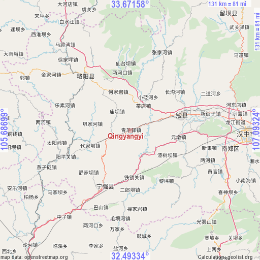
Qingyangyi GPS coordinates[2]
33° 5' 3.948" North, 106° 23' 24.396" East
| Map corner | latitude | longitude |
|---|---|---|
| Upper-left | 33.67158°, | 105.68699° |
| Center: | 33.08443°, | 106.39011° |
| Lower-right: | 32.49334°, | 107.09324° |
| Map W x H: | 131×131 km | = 81.4×81.4mi |
| max Lat: | 53.31946° ⇑33.5% North |
| Qingyangyi: | 33.08443° |
| min Lat: | ⇓66.5% South 18.22056° |
| min Long | Qingyangyi | max Long |
| 75.07348° | 106.39011° | 134.28917° |
| W 14.5%⇐ | ⇒85.5% E |
Elevation
Elevation of Qingyangyi is 673 m = 2208 ft, and this is 188.2 m = 617 ft above average elevation for this country.
| Max E: |
5622 m = 18445 ft | 20.4% |
| Qingyangyi | 673 m 2208 ft | |
| Avg. | 484.8 m = 1591 ft | |
Min E: |
-3 m = -10 ft | 79.6% |
See also: China elevation on elevation.city.
Geographical zone
Qingyangyi is located in North temperate zone (between Tropic of Cancer and the Arctic Circle). Distance of this Northern Tropic circle is 1072.7 km =666.5 mi to South.| Distance of | km | miles | from Qingyangyi |
|---|---|---|---|
| North Pole | 6328.4 | 3932.3 | to North |
| Arctic Circle | 3722.5 | 2313.1 | to North |
| Tropic Cancer | 1072.7 | 666.5 | to South |
| Equator | 3678.6 | 2285.8 | to South |


Nearby cities:
15 places around Qingyangyi: (largest is in red/bold)
• Chadian
13.3 km =8.3 mi,  29°
29°
• Daijiaba
21 km =13 mi,  246°
246°
• Da’an
9.3 km =5.8 mi, 250°
• Donghuanggou
15.3 km =9.5 mi,  278°
278°
• Gongjiahe
19.4 km =12.1 mi, 279°
• Heiheba
15.2 km =9.4 mi,  19°
19°
• Hejiayan
20.3 km =12.6 mi,  342°
342°
• Hujiaba
14 km =8.7 mi,  148°
148°
• Kuanchuan
15.8 km =9.8 mi,  230°
230°
• Miaoba
11.4 km =7.1 mi,  325°
325°
• Nanping
7.7 km =4.8 mi,  179°
179°
• Tuguanpu
15.7 km =9.8 mi,  71°
71°
• Xiakouyi
14.2 km =8.8 mi,  6°
6°
• Xiaobianhe
18.9 km =11.7 mi, 29°
• Xinpu
5.8 km =3.6 mi, 72°
Sources, notices
• [Note1] Compared only with cities in China existing in our database
• [Src1] Map data: © OpenStreetMap contributors (CC-BY-SA)
• [Src2] Other city data from geonames.org with taken over terms of usage.
• [Src3] Geographical zone / Annual Mean Temperature by Robert A. Rohde @ Wikipedia
