Minyue geodata
Minyue (Heilongjiang) is a seat of a fourth-order administrative division; located in China in Asia/Shanghai (GMT+8) time zone. In our database, there are 1268 cities with bigger population. Compared to other cities in China, 93.9% of cities are located further ↓South; 96.8% of cities are located further ←West and 50.1% of cities have lower elevation than Minyue. Note1


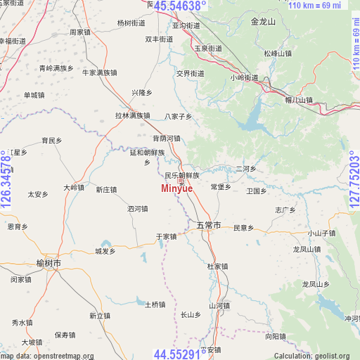
Minyue GPS coordinates[2]
45° 3' 6.48" North, 127° 2' 56.04" East
| Map corner | latitude | longitude |
|---|---|---|
| Upper-left | 45.54638°, | 126.34578° |
| Center: | 45.0518°, | 127.0489° |
| Lower-right: | 44.55291°, | 127.75203° |
| Map W x H: | 110.5×110.5 km | = 68.7×68.7mi |
| max Lat: | 53.31946° ⇑6.1% North |
| Minyue: | 45.0518° |
| min Lat: | ⇓93.9% South 18.22056° |
| min Long | Minyue | max Long |
| 75.07348° | 127.0489° | 134.28917° |
| W 96.8%⇐ | ⇒3.2% E |
Elevation
Elevation of Minyue is 166 m = 545 ft, and this is 318.8 m = 1046 ft below average elevation for this country.
| Max E: |
5622 m = 18445 ft | 49.9% |
| Avg. | 484.8 m = 1591 ft | |
| Minyue | 166 m = 545 ft | |
Min E: |
-3 m = -10 ft | 50.1% |
See also: China elevation on elevation.city.
Geographical zone
Minyue is located in North temperate zone (between Tropic of Cancer and the Arctic Circle). Distance of this North polar circle is 2391.9 km =1486.3 mi to North.| Distance of | km | miles | from Minyue |
|---|---|---|---|
| North Pole | 4997.8 | 3105.5 | to North |
| Arctic Circle | 2391.9 | 1486.3 | to North |
| Tropic Cancer | 2403.4 | 1493.4 | to South |
| Equator | 5009.3 | 3112.6 | to South |


Nearby cities:
15 places around Minyue: (largest is in red/bold)
• Anjia
1.5 km =0.9 mi,  93°
93°
• Bajiazi
19.7 km =12.2 mi,  358°
358°
• Beiyinhe
13.3 km =8.3 mi,  343°
343°
• Changbao
12.7 km =7.9 mi,  98°
98°
• Erhe
20.8 km =12.9 mi,  81°
81°
• Jiaojie
33 km =20.5 mi,  5°
5°
• Minyi
24 km =14.9 mi,  125°
125°
• Qingshan
12.4 km =7.7 mi,  289°
289°
• Weiguo
23.7 km =14.7 mi, 97°
• Wuchang
17.2 km =10.7 mi,  152°
152°
• Xiaoling
37.5 km =23.3 mi,  32°
32°
• Xinglong
30 km =18.6 mi, 337°
• Yanhe
12.4 km =7.7 mi,  305°
305°
• Yingchengzi
14.8 km =9.2 mi,  330°
330°
• Zhiguang
33.6 km =20.9 mi,  105°
105°
Sources, notices
• [Note1] Compared only with cities in China existing in our database
• [Src1] Map data: © OpenStreetMap contributors (CC-BY-SA)
• [Src2] Other city data from geonames.org with taken over terms of usage.
• [Src3] Geographical zone / Annual Mean Temperature by Robert A. Rohde @ Wikipedia
