Jiaojie geodata
Jiaojie (Heilongjiang) is a seat of a fourth-order administrative division; located in China in Asia/Shanghai (GMT+8) time zone. In our database, there are 1268 cities with bigger population. Compared to other cities in China, 94.2% of cities are located further ↓South; 96.8% of cities are located further ←West and 51.7% of cities have lower elevation than Jiaojie. Note1


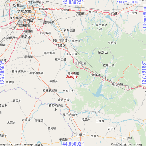
Jiaojie GPS coordinates[2]
45° 20' 50.064" North, 127° 5' 19.5" East
| Map corner | latitude | longitude |
|---|---|---|
| Upper-left | 45.83925°, | 126.38563° |
| Center: | 45.34724°, | 127.08875° |
| Lower-right: | 44.85092°, | 127.79188° |
| Map W x H: | 109.9×109.9 km | = 68.3×68.3mi |
| max Lat: | 53.31946° ⇑5.8% North |
| Jiaojie: | 45.34724° |
| min Lat: | ⇓94.2% South 18.22056° |
| min Long | Jiaojie | max Long |
| 75.07348° | 127.08875° | 134.28917° |
| W 96.8%⇐ | ⇒3.2% E |
Elevation
Elevation of Jiaojie is 179 m = 587 ft, and this is 305.8 m = 1003 ft below average elevation for this country.
| Max E: |
5622 m = 18445 ft | 48.3% |
| Avg. | 484.8 m = 1591 ft | |
| Jiaojie | 179 m = 587 ft | |
Min E: |
-3 m = -10 ft | 51.7% |
See also: China elevation on elevation.city.
Geographical zone
Jiaojie is located in North temperate zone (between Tropic of Cancer and the Arctic Circle). Distance of this North polar circle is 2359 km =1465.8 mi to North.| Distance of | km | miles | from Jiaojie |
|---|---|---|---|
| North Pole | 4964.9 | 3085 | to North |
| Arctic Circle | 2359 | 1465.8 | to North |
| Tropic Cancer | 2436.2 | 1513.8 | to South |
| Equator | 5042.1 | 3133 | to South |


Nearby cities:
15 places around Jiaojie: (largest is in red/bold)
• Acheng
23.7 km =14.7 mi,  338°
338°
• Ashihe
22.8 km =14.2 mi, 336°
• Bajiazi
13.6 km =8.5 mi,  195°
195°
• Beiyinhe
21.2 km =13.2 mi, 199°
• Daling
17.8 km =11.1 mi,  6°
6°
• Hongxing
24.4 km =15.2 mi,  4°
4°
• Pingshan
24.3 km =15.1 mi,  96°
96°
• Sheli
27.2 km =16.9 mi,  332°
332°
• Shuangfeng
14.2 km =8.8 mi,  317°
317°
• Songfengshan
27.4 km =17 mi,  77°
77°
• Xiaoling
17 km =10.6 mi,  94°
94°
• Xinglong
15.7 km =9.8 mi,  250°
250°
• Yagou
14.8 km =9.2 mi,  357°
357°
• Yingchengzi
22.5 km =14 mi,  207°
207°
• Yuquan
8.9 km =5.5 mi,  38°
38°
Sources, notices
• [Note1] Compared only with cities in China existing in our database
• [Src1] Map data: © OpenStreetMap contributors (CC-BY-SA)
• [Src2] Other city data from geonames.org with taken over terms of usage.
• [Src3] Geographical zone / Annual Mean Temperature by Robert A. Rohde @ Wikipedia
