Baishazhou geodata
Baishazhou (Jiangxi) is a seat of a fourth-order administrative division; located in China in Asia/Shanghai (GMT+8) time zone. In our database, there are 1268 cities with bigger population. Compared to other cities in China, 63.7% of cities are located further ↑North; 63.8% of cities are located further ←West and 81.2% of cities have higher elevation than Baishazhou. Note1


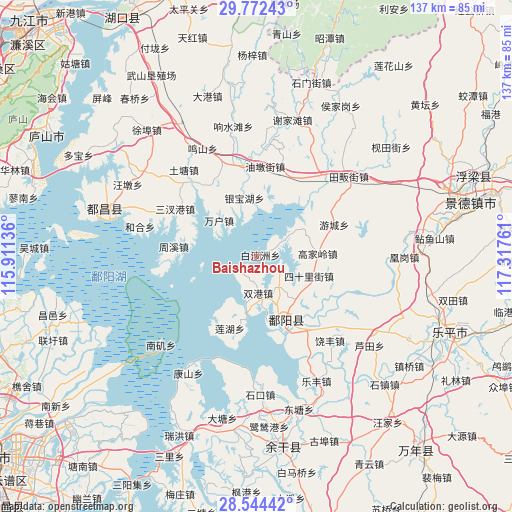
Baishazhou GPS coordinates[2]
29° 9' 36.936" North, 116° 36' 52.128" East
| Map corner | latitude | longitude |
|---|---|---|
| Upper-left | 29.77243°, | 115.91136° |
| Center: | 29.16026°, | 116.61448° |
| Lower-right: | 28.54442°, | 117.31761° |
| Map W x H: | 136.5×136.5 km | = 84.8×84.8mi |
| max Lat: | 53.31946° ⇑63.7% North |
| Baishazhou: | 29.16026° |
| min Lat: | ⇓36.3% South 18.22056° |
| min Long | Baishazhou | max Long |
| 75.07348° | 116.61448° | 134.28917° |
| W 63.8%⇐ | ⇒36.2% E |
Elevation
Elevation of Baishazhou is 24 m = 79 ft, and this is 460.8 m = 1512 ft below average elevation for this country.
| Max E: |
5622 m = 18445 ft | 81.2% |
| Avg. | 484.8 m = 1591 ft | |
| Baishazhou | 24 m = 79 ft | |
Min E: |
-3 m = -10 ft | 18.8% |
See also: China elevation on elevation.city.
Geographical zone
Baishazhou is located in North temperate zone (between Tropic of Cancer and the Arctic Circle). Distance of this Northern Tropic circle is 636.4 km =395.4 mi to South.| Distance of | km | miles | from Baishazhou |
|---|---|---|---|
| North Pole | 6764.7 | 4203.4 | to North |
| Arctic Circle | 4158.9 | 2584.2 | to North |
| Tropic Cancer | 636.4 | 395.4 | to South |
| Equator | 3242.3 | 2014.7 | to South |


Nearby cities:
15 places around Baishazhou: (largest is in red/bold)
• Gaojialing
16.3 km =10.1 mi,  87°
87°
• Lianhu
19.6 km =12.2 mi,  201°
201°
• Nanfeng
12.5 km =7.8 mi,  335°
335°
• Poyang
19.4 km =12.1 mi,  164°
164°
• Shuanggang
9.5 km =5.9 mi,  179°
179°
• Sishi Lijie
14.8 km =9.2 mi,  110°
110°
• Tuanlin
13 km =8.1 mi,  138°
138°
• Wanhu
13.6 km =8.5 mi,  313°
313°
• Xiangxi
11 km =6.8 mi,  324°
324°
• Xiyuan
19.6 km =12.2 mi,  288°
288°
• Yaquehu
18.3 km =11.4 mi,  4°
4°
• Yinbaohu
14.9 km =9.3 mi,  346°
346°
• Youcheng
22.6 km =14 mi,  68°
68°
• Zhouxi
22 km =13.7 mi,  277°
277°
• Zhuhu
6.2 km =3.9 mi,  61°
61°
Sources, notices
• [Note1] Compared only with cities in China existing in our database
• [Src1] Map data: © OpenStreetMap contributors (CC-BY-SA)
• [Src2] Other city data from geonames.org with taken over terms of usage.
• [Src3] Geographical zone / Annual Mean Temperature by Robert A. Rohde @ Wikipedia
