Baota geodata
Baota (Jiangxi) is a seat of a fourth-order administrative division; located in China in Asia/Shanghai (GMT+8) time zone. In our database, there are 1268 cities with bigger population. Compared to other cities in China, 61.7% of cities are located further ↑North; 58.5% of cities are located further ←West and 78.3% of cities have higher elevation than Baota. Note1


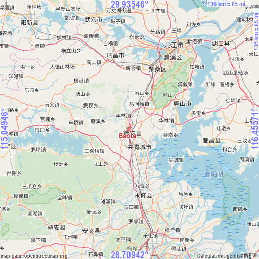
Baota GPS coordinates[2]
29° 19' 27.408" North, 115° 45' 9.288" East
| Map corner | latitude | longitude |
|---|---|---|
| Upper-left | 29.93546°, | 115.04946° |
| Center: | 29.32428°, | 115.75258° |
| Lower-right: | 28.70942°, | 116.45571° |
| Map W x H: | 136.3×136.3 km | = 84.7×84.7mi |
| max Lat: | 53.31946° ⇑61.7% North |
| Baota: | 29.32428° |
| min Lat: | ⇓38.3% South 18.22056° |
| min Long | Baota | max Long |
| 75.07348° | 115.75258° | 134.28917° |
| W 58.5%⇐ | ⇒41.5% E |
Elevation
Elevation of Baota is 30 m = 98 ft, and this is 454.8 m = 1492 ft below average elevation for this country.
| Max E: |
5622 m = 18445 ft | 78.3% |
| Avg. | 484.8 m = 1591 ft | |
| Baota | 30 m = 98 ft | |
Min E: |
-3 m = -10 ft | 21.7% |
See also: China elevation on elevation.city.
Geographical zone
Baota is located in North temperate zone (between Tropic of Cancer and the Arctic Circle). Distance of this Northern Tropic circle is 654.6 km =406.7 mi to South.| Distance of | km | miles | from Baota |
|---|---|---|---|
| North Pole | 6746.5 | 4192.1 | to North |
| Arctic Circle | 4140.6 | 2572.8 | to North |
| Tropic Cancer | 654.6 | 406.7 | to South |
| Equator | 3260.6 | 2026 | to South |


Nearby cities:
15 places around Baota: (largest is in red/bold)
• Fenglin
8.3 km =5.2 mi,  336°
336°
• Ganlu
8 km =5 mi,  172°
172°
• Gaotang
10.3 km =6.4 mi,  12°
12°
• Hedong
2 km =1.2 mi,  40°
40°
• Hengtang
13.3 km =8.3 mi,  79°
79°
• Jiangyi
12.7 km =7.9 mi, 171°
• Jinhu
7.1 km =4.4 mi,  122°
122°
• Linquan
15.4 km =9.6 mi,  350°
350°
• Mahuiling
14.4 km =8.9 mi,  19°
19°
• Meitang
15 km =9.3 mi,  233°
233°
• Nieqiao
12.3 km =7.6 mi,  307°
307°
• Puting
0.9 km =0.6 mi,  31°
31°
• Sujiadang
12.8 km =8 mi,  114°
114°
• Yanfang
12.3 km =7.6 mi,  204°
204°
• Zequan
9.2 km =5.7 mi,  89°
89°
Sources, notices
• [Note1] Compared only with cities in China existing in our database
• [Src1] Map data: © OpenStreetMap contributors (CC-BY-SA)
• [Src2] Other city data from geonames.org with taken over terms of usage.
• [Src3] Geographical zone / Annual Mean Temperature by Robert A. Rohde @ Wikipedia
