Chaowai geodata
Chaowai (Beijing) is a seat of a third-order administrative division; located in China in Asia/Shanghai (GMT+8) time zone. In our database, there are 1268 cities with bigger population. Compared to other cities in China, 86.1% of cities are located further ↓South; 62.7% of cities are located further ←West and 70.8% of cities have higher elevation than Chaowai. Note1


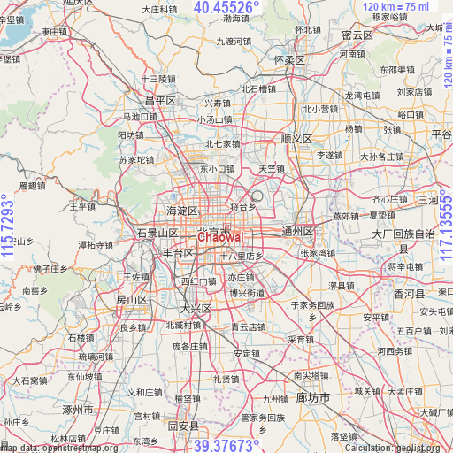
Chaowai GPS coordinates[2]
39° 55' 5.232" North, 116° 25' 56.712" East
| Map corner | latitude | longitude |
|---|---|---|
| Upper-left | 40.45526°, | 115.7293° |
| Center: | 39.91812°, | 116.43242° |
| Lower-right: | 39.37673°, | 117.13555° |
| Map W x H: | 119.9×119.9 km | = 74.5×74.5mi |
| max Lat: | 53.31946° ⇑13.9% North |
| Chaowai: | 39.91812° |
| min Lat: | ⇓86.1% South 18.22056° |
| min Long | Chaowai | max Long |
| 75.07348° | 116.43242° | 134.28917° |
| W 62.7%⇐ | ⇒37.3% E |
Elevation
Elevation of Chaowai is 49 m = 161 ft, and this is 435.8 m = 1430 ft below average elevation for this country.
| Max E: |
5622 m = 18445 ft | 70.8% |
| Avg. | 484.8 m = 1591 ft | |
| Chaowai | 49 m = 161 ft | |
Min E: |
-3 m = -10 ft | 29.2% |
See also: China elevation on elevation.city.
Geographical zone
Chaowai is located in North temperate zone (between Tropic of Cancer and the Arctic Circle). Distance of this Northern Tropic circle is 1832.6 km =1138.7 mi to South.| Distance of | km | miles | from Chaowai |
|---|---|---|---|
| North Pole | 5568.6 | 3460.2 | to North |
| Arctic Circle | 2962.7 | 1840.9 | to North |
| Tropic Cancer | 1832.6 | 1138.7 | to South |
| Equator | 4438.5 | 2758 | to South |


Nearby cities:
15 places around Chaowai: (largest is in red/bold)
• Baizhifang
7.9 km =4.9 mi,  240°
240°
• Beijing
3.2 km =2 mi,  248°
248°
• Dahongmen
9.6 km =6 mi,  197°
197°
• Datun
7.8 km =4.8 mi,  350°
350°
• Dongba
11.4 km =7.1 mi,  64°
64°
• Dongfeng
6.1 km =3.8 mi,  70°
70°
• Huaxiang
13.3 km =8.3 mi,  223°
223°
• Jingshan
2.5 km =1.6 mi,  288°
288°
• Jinrongjie
6.5 km =4 mi,  264°
264°
• Jiugong
12.9 km =8 mi,  172°
172°
• Laiguangying
11.9 km =7.4 mi,  0°
0°
• Longtan
3.9 km =2.4 mi,  187°
187°
• Nanyuan
13.3 km =8.3 mi, 195°
• Wangjing
9 km =5.6 mi,  22°
22°
• Xincun
14.1 km =8.8 mi,  231°
231°
Sources, notices
• [Note1] Compared only with cities in China existing in our database
• [Src1] Map data: © OpenStreetMap contributors (CC-BY-SA)
• [Src2] Other city data from geonames.org with taken over terms of usage.
• [Src3] Geographical zone / Annual Mean Temperature by Robert A. Rohde @ Wikipedia
