Dongcheng geodata
Dongcheng (Zhejiang) is a seat of a third-order administrative division; located in China in Asia/Shanghai (GMT+8) time zone. In our database, there are 1268 cities with bigger population. Compared to other cities in China, 66.4% of cities are located further ↑North; 82.2% of cities are located further ←West and 62.1% of cities have higher elevation than Dongcheng. Note1


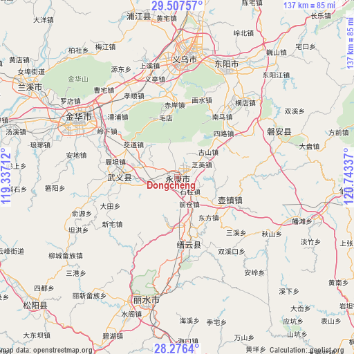
Dongcheng GPS coordinates[2]
28° 53' 37.716" North, 120° 2' 24.864" East
| Map corner | latitude | longitude |
|---|---|---|
| Upper-left | 29.50757°, | 119.33712° |
| Center: | 28.89381°, | 120.04024° |
| Lower-right: | 28.2764°, | 120.74337° |
| Map W x H: | 136.9×136.9 km | = 85.1×85.1mi |
| max Lat: | 53.31946° ⇑66.4% North |
| Dongcheng: | 28.89381° |
| min Lat: | ⇓33.6% South 18.22056° |
| min Long | Dongcheng | max Long |
| 75.07348° | 120.04024° | 134.28917° |
| W 82.2%⇐ | ⇒17.8% E |
Elevation
Elevation of Dongcheng is 87 m = 285 ft, and this is 397.8 m = 1305 ft below average elevation for this country.
| Max E: |
5622 m = 18445 ft | 62.1% |
| Avg. | 484.8 m = 1591 ft | |
| Dongcheng | 87 m = 285 ft | |
Min E: |
-3 m = -10 ft | 37.9% |
See also: China elevation on elevation.city.
Geographical zone
Dongcheng is located in North temperate zone (between Tropic of Cancer and the Arctic Circle). Distance of this Northern Tropic circle is 606.8 km =377 mi to South.| Distance of | km | miles | from Dongcheng |
|---|---|---|---|
| North Pole | 6794.4 | 4221.8 | to North |
| Arctic Circle | 4188.5 | 2602.6 | to North |
| Tropic Cancer | 606.8 | 377 | to South |
| Equator | 3212.7 | 1996.3 | to South |


Nearby cities:
15 places around Dongcheng: (largest is in red/bold)
• Dongfang
19.7 km =12.2 mi,  141°
141°
• Fangyan
15.3 km =9.5 mi,  71°
71°
• Guli
1.5 km =0.9 mi,  207°
207°
• Gushan
15.6 km =9.7 mi,  50°
50°
• Huajie
7.8 km =4.8 mi,  294°
294°
• Jiangnan
1.6 km =1 mi,  259°
259°
• Longshan
19.9 km =12.4 mi,  43°
43°
• Qiancang
11.3 km =7 mi,  155°
155°
• Shizhu
7.6 km =4.7 mi,  134°
134°
• Xiangzhu
11.4 km =7.1 mi,  20°
20°
• Xicheng
1.9 km =1.2 mi,  276°
276°
• Xinbi
16 km =9.9 mi, 163°
• Xinjian
19 km =11.8 mi,  186°
186°
• Zhiying
10.1 km =6.3 mi, 54°
• Zhoushan
16.5 km =10.3 mi, 127°
Sources, notices
• [Note1] Compared only with cities in China existing in our database
• [Src1] Map data: © OpenStreetMap contributors (CC-BY-SA)
• [Src2] Other city data from geonames.org with taken over terms of usage.
• [Src3] Geographical zone / Annual Mean Temperature by Robert A. Rohde @ Wikipedia
