Zhongping geodata
Zhongping (Chongqing) is a seat of a fourth-order administrative division; located in China in Asia/Shanghai (GMT+8) time zone. In our database, there are 1268 cities with bigger population. Compared to other cities in China, 70.5% of cities are located further ↑North; 75.7% of cities are located further →East and 70.4% of cities have lower elevation than Zhongping. Note1


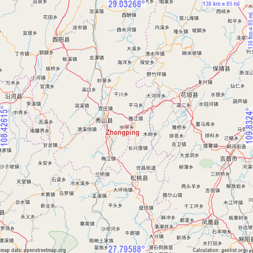
Zhongping GPS coordinates[2]
28° 24' 57.924" North, 109° 7' 45.372" East
| Map corner | latitude | longitude |
|---|---|---|
| Upper-left | 29.03268°, | 108.42615° |
| Center: | 28.41609°, | 109.12927° |
| Lower-right: | 27.79588°, | 109.8324° |
| Map W x H: | 137.5×137.5 km | = 85.4×85.4mi |
| max Lat: | 53.31946° ⇑70.5% North |
| Zhongping: | 28.41609° |
| min Lat: | ⇓29.5% South 18.22056° |
| min Long | Zhongping | max Long |
| 75.07348° | 109.12927° | 134.28917° |
| W 24.3%⇐ | ⇒75.7% E |
Elevation
Elevation of Zhongping is 418 m = 1371 ft, and this is 66.8 m = 219 ft below average elevation for this country.
| Max E: |
5622 m = 18445 ft | 29.6% |
| Avg. | 484.8 m = 1591 ft | |
| Zhongping | 418 m = 1371 ft | |
Min E: |
-3 m = -10 ft | 70.4% |
See also: China elevation on elevation.city.
Geographical zone
Zhongping is located in North temperate zone (between Tropic of Cancer and the Arctic Circle). Distance of this Northern Tropic circle is 553.7 km =344.1 mi to South.| Distance of | km | miles | from Zhongping |
|---|---|---|---|
| North Pole | 6847.5 | 4254.8 | to North |
| Arctic Circle | 4241.6 | 2635.6 | to North |
| Tropic Cancer | 553.7 | 344.1 | to South |
| Equator | 3159.6 | 1963.3 | to South |


Nearby cities:
15 places around Zhongping: (largest is in red/bold)
• Cenxi
8.9 km =5.5 mi,  193°
193°
• Changxingbao
12.6 km =7.8 mi,  150°
150°
• Ganchuan
18.2 km =11.3 mi,  350°
350°
• Guanzhou
10.8 km =6.7 mi,  269°
269°
• Guanzhuang
15.4 km =9.6 mi,  311°
311°
• Hong’an
16.5 km =10.3 mi,  54°
54°
• Huangban
18.3 km =11.4 mi,  170°
170°
• Minle
16.9 km =10.5 mi,  101°
101°
• Mushu
13.3 km =8.3 mi,  105°
105°
• Pingkai
13.1 km =8.1 mi, 274°
• Pingma
13.1 km =8.1 mi,  22°
22°
• Shiye
8 km =5 mi,  241°
241°
• Yajia
6.9 km =4.3 mi, 51°
• Yajiang
6.7 km =4.2 mi,  44°
44°
• Zhonghe
14.2 km =8.8 mi,  285°
285°
Sources, notices
• [Note1] Compared only with cities in China existing in our database
• [Src1] Map data: © OpenStreetMap contributors (CC-BY-SA)
• [Src2] Other city data from geonames.org with taken over terms of usage.
• [Src3] Geographical zone / Annual Mean Temperature by Robert A. Rohde @ Wikipedia
