Liangzeng geodata
Liangzeng (Chongqing) is a seat of a fourth-order administrative division; located in China in Asia/Shanghai (GMT+8) time zone. In our database, there are 1268 cities with bigger population. Compared to other cities in China, 66.5% of cities are located further ↑North; 79% of cities are located further →East and 71.7% of cities have lower elevation than Liangzeng. Note1


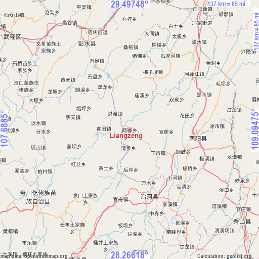
Liangzeng GPS coordinates[2]
28° 53' 1.14" North, 108° 23' 29.832" East
| Map corner | latitude | longitude |
|---|---|---|
| Upper-left | 29.49748°, | 107.6885° |
| Center: | 28.88365°, | 108.39162° |
| Lower-right: | 28.26618°, | 109.09475° |
| Map W x H: | 136.9×136.9 km | = 85.1×85.1mi |
| max Lat: | 53.31946° ⇑66.5% North |
| Liangzeng: | 28.88365° |
| min Lat: | ⇓33.5% South 18.22056° |
| min Long | Liangzeng | max Long |
| 75.07348° | 108.39162° | 134.28917° |
| W 21%⇐ | ⇒79% E |
Elevation
Elevation of Liangzeng is 446 m = 1463 ft, and this is 38.8 m = 127 ft below average elevation for this country.
| Max E: |
5622 m = 18445 ft | 28.3% |
| Avg. | 484.8 m = 1591 ft | |
| Liangzeng | 446 m = 1463 ft | |
Min E: |
-3 m = -10 ft | 71.7% |
See also: China elevation on elevation.city.
Geographical zone
Liangzeng is located in North temperate zone (between Tropic of Cancer and the Arctic Circle). Distance of this Northern Tropic circle is 605.6 km =376.3 mi to South.| Distance of | km | miles | from Liangzeng |
|---|---|---|---|
| North Pole | 6795.5 | 4222.5 | to North |
| Arctic Circle | 4189.6 | 2603.3 | to North |
| Tropic Cancer | 605.6 | 376.3 | to South |
| Equator | 3211.6 | 1995.6 | to South |


Nearby cities:
15 places around Liangzeng: (largest is in red/bold)
• Cangling
24.1 km =15 mi,  57°
57°
• Dingshi
19.3 km =12 mi,  128°
128°
• Gongtan
5 km =3.1 mi,  302°
302°
• Hongdu
11.6 km =7.2 mi,  319°
319°
• Houpingba
20.9 km =13 mi,  178°
178°
• Huangtu
23.5 km =14.6 mi,  211°
211°
• Ketian
13.7 km =8.5 mi,  273°
273°
• Miaoxi
19.6 km =12.2 mi,  19°
19°
• Qingshui
9.5 km =5.9 mi, 183°
• Shangan
22.4 km =13.9 mi,  350°
350°
• Siqu
24 km =14.9 mi,  192°
192°
• Tangba
20.5 km =12.7 mi,  311°
311°
• Tianguan
8.3 km =5.2 mi, 126°
• Xinjing
9 km =5.6 mi, 272°
• Yiju
19.4 km =12.1 mi,  92°
92°
Sources, notices
• [Note1] Compared only with cities in China existing in our database
• [Src1] Map data: © OpenStreetMap contributors (CC-BY-SA)
• [Src2] Other city data from geonames.org with taken over terms of usage.
• [Src3] Geographical zone / Annual Mean Temperature by Robert A. Rohde @ Wikipedia
