Tangba geodata
Tangba (Guizhou) is a seat of a fourth-order administrative division; located in China in Asia/Shanghai (GMT+8) time zone. In our database, there are 1268 cities with bigger population. Compared to other cities in China, 65.4% of cities are located further ↑North; 79.7% of cities are located further →East and 77% of cities have lower elevation than Tangba. Note1


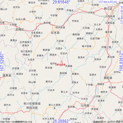
Tangba GPS coordinates[2]
29° 0' 19.368" North, 108° 13' 58.764" East
| Map corner | latitude | longitude |
|---|---|---|
| Upper-left | 29.61848°, | 107.52987° |
| Center: | 29.00538°, | 108.23299° |
| Lower-right: | 28.38862°, | 108.93612° |
| Map W x H: | 136.7×136.7 km | = 84.9×84.9mi |
| max Lat: | 53.31946° ⇑65.4% North |
| Tangba: | 29.00538° |
| min Lat: | ⇓34.6% South 18.22056° |
| min Long | Tangba | max Long |
| 75.07348° | 108.23299° | 134.28917° |
| W 20.3%⇐ | ⇒79.7% E |
Elevation
Elevation of Tangba is 577 m = 1893 ft, and this is 92.2 m = 302 ft above average elevation for this country.
| Max E: |
5622 m = 18445 ft | 23% |
| Tangba | 577 m 1893 ft | |
| Avg. | 484.8 m = 1591 ft | |
Min E: |
-3 m = -10 ft | 77% |
See also: China elevation on elevation.city.
Geographical zone
Tangba is located in North temperate zone (between Tropic of Cancer and the Arctic Circle). Distance of this Northern Tropic circle is 619.2 km =384.8 mi to South.| Distance of | km | miles | from Tangba |
|---|---|---|---|
| North Pole | 6782 | 4214.1 | to North |
| Arctic Circle | 4176.1 | 2594.9 | to North |
| Tropic Cancer | 619.2 | 384.8 | to South |
| Equator | 3225.1 | 2004 | to South |


Nearby cities:
15 places around Tangba: (largest is in red/bold)
• Gongtan
15.6 km =9.7 mi,  134°
134°
• Gouping
9 km =5.6 mi,  257°
257°
• Hongdu
9.1 km =5.7 mi,  121°
121°
• Huangjia
21.6 km =13.4 mi,  307°
307°
• Ketian
12.9 km =8 mi,  172°
172°
• Langxi
11.8 km =7.3 mi, 308°
• Liangzeng
20.5 km =12.7 mi, 131°
• Lujiao
15.2 km =9.4 mi,  19°
19°
• Maotian
15.9 km =9.9 mi,  245°
245°
• Miaoxi
22.5 km =14 mi,  77°
77°
• Shangan
14.6 km =9.1 mi,  54°
54°
• Shipan
15.1 km =9.4 mi,  349°
349°
• Shuanglong
9.7 km =6 mi,  14°
14°
• Xinjing
14.7 km =9.1 mi,  153°
153°
• Xintian
21.5 km =13.4 mi, 9°
Sources, notices
• [Note1] Compared only with cities in China existing in our database
• [Src1] Map data: © OpenStreetMap contributors (CC-BY-SA)
• [Src2] Other city data from geonames.org with taken over terms of usage.
• [Src3] Geographical zone / Annual Mean Temperature by Robert A. Rohde @ Wikipedia
