Zhangdan geodata
Zhangdan (Zhejiang) is a seat of a fourth-order administrative division; located in China in Asia/Shanghai (GMT+8) time zone. In our database, there are 1268 cities with bigger population. Compared to other cities in China, 73.1% of cities are located further ↑North; 83.6% of cities are located further ←West and 67% of cities have lower elevation than Zhangdan. Note1


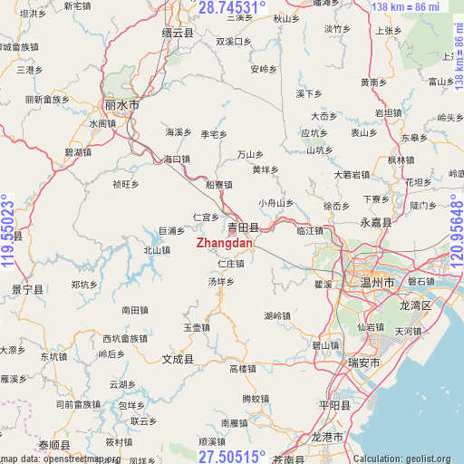
Zhangdan GPS coordinates[2]
28° 7' 37.272" North, 120° 15' 12.06" East
| Map corner | latitude | longitude |
|---|---|---|
| Upper-left | 28.74531°, | 119.55023° |
| Center: | 28.12702°, | 120.25335° |
| Lower-right: | 27.50515°, | 120.95648° |
| Map W x H: | 137.9×137.9 km | = 85.7×85.7mi |
| max Lat: | 53.31946° ⇑73.1% North |
| Zhangdan: | 28.12702° |
| min Lat: | ⇓26.9% South 18.22056° |
| min Long | Zhangdan | max Long |
| 75.07348° | 120.25335° | 134.28917° |
| W 83.6%⇐ | ⇒16.4% E |
Elevation
Elevation of Zhangdan is 359 m = 1178 ft, and this is 125.8 m = 413 ft below average elevation for this country.
| Max E: |
5622 m = 18445 ft | 33% |
| Avg. | 484.8 m = 1591 ft | |
| Zhangdan | 359 m = 1178 ft | |
Min E: |
-3 m = -10 ft | 67% |
See also: China elevation on elevation.city.
Geographical zone
Zhangdan is located in North temperate zone (between Tropic of Cancer and the Arctic Circle). Distance of this Northern Tropic circle is 521.5 km =324 mi to South.| Distance of | km | miles | from Zhangdan |
|---|---|---|---|
| North Pole | 6879.6 | 4274.8 | to North |
| Arctic Circle | 4273.7 | 2655.6 | to North |
| Tropic Cancer | 521.5 | 324 | to South |
| Equator | 3127.4 | 1943.3 | to South |


Nearby cities:
15 places around Zhangdan: (largest is in red/bold)
• Bushan
8.9 km =5.5 mi,  235°
235°
• Chuanliao
15.1 km =9.4 mi,  344°
344°
• Fangshan
12.9 km =8 mi,  152°
152°
• Gaoshi
19.7 km =12.2 mi,  320°
320°
• Gui’ao
11.1 km =6.9 mi,  62°
62°
• Hecheng
3.7 km =2.3 mi,  67°
67°
• Jupu
18.1 km =11.2 mi,  272°
272°
• Rengong
9.2 km =5.7 mi,  301°
301°
• Renzhuang
9.1 km =5.7 mi,  183°
183°
• Shankou
8.8 km =5.5 mi,  135°
135°
• Shixi
7.7 km =4.8 mi,  352°
352°
• Shuangchao
18.8 km =11.7 mi,  85°
85°
• Wenxi
13.5 km =8.4 mi, 74°
• Wukeng
19.4 km =12.1 mi,  48°
48°
• Xiaozhoushan
15.6 km =9.7 mi, 55°
Sources, notices
• [Note1] Compared only with cities in China existing in our database
• [Src1] Map data: © OpenStreetMap contributors (CC-BY-SA)
• [Src2] Other city data from geonames.org with taken over terms of usage.
• [Src3] Geographical zone / Annual Mean Temperature by Robert A. Rohde @ Wikipedia
