Zhongshanlu geodata
Zhongshanlu (Chongqing) is a seat of a third-order administrative division; located in China in Asia/Shanghai (GMT+8) time zone. In our database, there are 1268 cities with bigger population. Compared to other cities in China, 61.3% of cities are located further ↑North; 87.2% of cities are located further →East and 64.1% of cities have lower elevation than Zhongshanlu. Note1


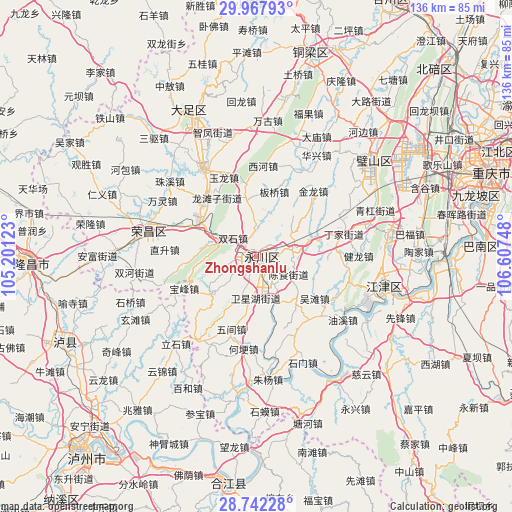
Zhongshanlu GPS coordinates[2]
29° 21' 25.02" North, 105° 54' 15.66" East
| Map corner | latitude | longitude |
|---|---|---|
| Upper-left | 29.96793°, | 105.20123° |
| Center: | 29.35695°, | 105.90435° |
| Lower-right: | 28.74228°, | 106.60748° |
| Map W x H: | 136.3×136.3 km | = 84.7×84.7mi |
| max Lat: | 53.31946° ⇑61.3% North |
| Zhongshanlu: | 29.35695° |
| min Lat: | ⇓38.7% South 18.22056° |
| min Long | Zhongshanlu | max Long |
| 75.07348° | 105.90435° | 134.28917° |
| W 12.8%⇐ | ⇒87.2% E |
Elevation
Elevation of Zhongshanlu is 312 m = 1024 ft, and this is 172.8 m = 567 ft below average elevation for this country.
| Max E: |
5622 m = 18445 ft | 35.9% |
| Avg. | 484.8 m = 1591 ft | |
| Zhongshanlu | 312 m = 1024 ft | |
Min E: |
-3 m = -10 ft | 64.1% |
See also: China elevation on elevation.city.
Geographical zone
Zhongshanlu is located in North temperate zone (between Tropic of Cancer and the Arctic Circle). Distance of this Northern Tropic circle is 658.3 km =409 mi to South.| Distance of | km | miles | from Zhongshanlu |
|---|---|---|---|
| North Pole | 6742.9 | 4189.8 | to North |
| Arctic Circle | 4137 | 2570.6 | to North |
| Tropic Cancer | 658.3 | 409 | to South |
| Equator | 3264.2 | 2028.3 | to South |


Nearby cities:
15 places around Zhongshanlu: (largest is in red/bold)
• Banqiao
18 km =11.2 mi,  15°
15°
• Chenshi
9.8 km =6.1 mi,  118°
118°
• Da’an
11.1 km =6.9 mi,  74°
74°
• Honglu
17.2 km =10.7 mi,  268°
268°
• Laisu
15.9 km =9.9 mi,  230°
230°
• Linjiang
13.4 km =8.3 mi,  157°
157°
• Nandajie
2.4 km =1.5 mi,  208°
208°
• Qingfeng
7.8 km =4.8 mi,  255°
255°
• Sanhe
19 km =11.8 mi,  92°
92°
• Sanjiao
15 km =9.3 mi,  346°
346°
• Shenglilu
2.7 km =1.7 mi,  254°
254°
• Shuangshi
8.1 km =5 mi,  306°
306°
• Shuangzhu
11.1 km =6.9 mi,  180°
180°
• Yongchuan
1.1 km =0.7 mi, 250°
• Youting
18.1 km =11.2 mi,  297°
297°
Sources, notices
• [Note1] Compared only with cities in China existing in our database
• [Src1] Map data: © OpenStreetMap contributors (CC-BY-SA)
• [Src2] Other city data from geonames.org with taken over terms of usage.
• [Src3] Geographical zone / Annual Mean Temperature by Robert A. Rohde @ Wikipedia
