Changqing geodata
Changqing (Heilongjiang) is a seat of a fourth-order administrative division; located in China in Asia/Shanghai (GMT+8) time zone. In our database, there are 1268 cities with bigger population. Compared to other cities in China, 97.4% of cities are located further ↓South; 93.3% of cities are located further ←West and 51.6% of cities have higher elevation than Changqing. Note1


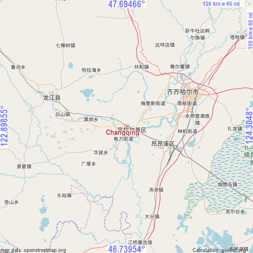
Changqing GPS coordinates[2]
47° 13' 9.3" North, 123° 36' 6.012" East
| Map corner | latitude | longitude |
|---|---|---|
| Upper-left | 47.69466°, | 122.89855° |
| Center: | 47.21925°, | 123.60167° |
| Lower-right: | 46.73954°, | 124.3048° |
| Map W x H: | 106.2×106.2 km | = 66×66mi |
| max Lat: | 53.31946° ⇑2.6% North |
| Changqing: | 47.21925° |
| min Lat: | ⇓97.4% South 18.22056° |
| min Long | Changqing | max Long |
| 75.07348° | 123.60167° | 134.28917° |
| W 93.3%⇐ | ⇒6.7% E |
Elevation
Elevation of Changqing is 152 m = 499 ft, and this is 332.8 m = 1092 ft below average elevation for this country.
| Max E: |
5622 m = 18445 ft | 51.6% |
| Avg. | 484.8 m = 1591 ft | |
| Changqing | 152 m = 499 ft | |
Min E: |
-3 m = -10 ft | 48.4% |
See also: China elevation on elevation.city.
Geographical zone
Changqing is located in North temperate zone (between Tropic of Cancer and the Arctic Circle). Distance of this North polar circle is 2150.9 km =1336.5 mi to North.| Distance of | km | miles | from Changqing |
|---|---|---|---|
| North Pole | 4756.8 | 2955.7 | to North |
| Arctic Circle | 2150.9 | 1336.5 | to North |
| Tropic Cancer | 2644.4 | 1643.2 | to South |
| Equator | 5250.3 | 3262.4 | to South |


Nearby cities:
15 places around Changqing: (largest is in red/bold)
• Baishan
27.6 km =17.1 mi,  281°
281°
• Damin
23.4 km =14.5 mi,  77°
77°
• Du’ermenqin
10 km =6.2 mi,  206°
206°
• Gonghe
26.1 km =16.2 mi,  13°
13°
• Guanghou
22.3 km =13.9 mi,  226°
226°
• Halahai
27.8 km =17.3 mi,  327°
327°
• Hali
12.6 km =7.8 mi,  18°
18°
• Heigang
15.6 km =9.7 mi, 281°
• Hong’an
2.3 km =1.4 mi,  130°
130°
• Huamin
15.5 km =9.6 mi, 226°
• Hulan Ergi
2.9 km =1.8 mi, 125°
• Meilisi
15.7 km =9.8 mi,  47°
47°
• Nanhang
28.2 km =17.5 mi,  67°
67°
• Xinxing
17.3 km =10.7 mi,  114°
114°
• Yushutun
22.8 km =14.2 mi, 108°
Sources, notices
• [Note1] Compared only with cities in China existing in our database
• [Src1] Map data: © OpenStreetMap contributors (CC-BY-SA)
• [Src2] Other city data from geonames.org with taken over terms of usage.
• [Src3] Geographical zone / Annual Mean Temperature by Robert A. Rohde @ Wikipedia
