Tuopu Luke geodata
Tuopu Luke (Xinjiang) is a seat of a fourth-order administrative division; located in China in Asia/Urumqi (GMT+6) time zone. In our database, there are 1268 cities with bigger population. Compared to other cities in China, 82.2% of cities are located further ↓South; 99.9% of cities are located further →East and 90.1% of cities have lower elevation than Tuopu Luke. Note1


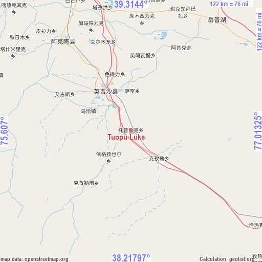
Tuopu Luke GPS coordinates[2]
38° 46' 5.844" North, 76° 18' 36.432" East
| Map corner | latitude | longitude |
|---|---|---|
| Upper-left | 39.3144°, | 75.607° |
| Center: | 38.76829°, | 76.31012° |
| Lower-right: | 38.21797°, | 77.01325° |
| Map W x H: | 121.9×121.9 km | = 75.7×75.7mi |
| max Lat: | 53.31946° ⇑17.8% North |
| Tuopu Luke: | 38.76829° |
| min Lat: | ⇓82.2% South 18.22056° |
| min Long | Tuopu Luke | max Long |
| 75.07348° | 76.31012° | 134.28917° |
| W 0.1%⇐ | ⇒99.9% E |
Elevation
Elevation of Tuopu Luke is 1369 m = 4491 ft, and this is 884.2 m = 2901 ft above average elevation for this country.
| Max E: |
5622 m = 18445 ft | 9.9% |
| Tuopu Luke | 1369 m 4491 ft | |
| Avg. | 484.8 m = 1591 ft | |
Min E: |
-3 m = -10 ft | 90.1% |
See also: China elevation on elevation.city.
Geographical zone
Tuopu Luke is located in North temperate zone (between Tropic of Cancer and the Arctic Circle). Distance of this Northern Tropic circle is 1704.7 km =1059.3 mi to South.| Distance of | km | miles | from Tuopu Luke |
|---|---|---|---|
| North Pole | 5696.4 | 3539.6 | to North |
| Arctic Circle | 3090.5 | 1920.3 | to North |
| Tropic Cancer | 1704.7 | 1059.3 | to South |
| Equator | 4310.6 | 2678.5 | to South |


Nearby cities:
15 places around Tuopu Luke: (largest is in red/bold)
• Aiximan
59.3 km =36.8 mi,  17°
17°
• Aqqik
45.8 km =28.5 mi,  29°
29°
• Chengguan
20.5 km =12.7 mi,  321°
321°
• Ha’erlong
31.2 km =19.4 mi,  220°
220°
• Kezilei
18.9 km =11.7 mi,  133°
133°
• Longfu
29.3 km =18.2 mi,  311°
311°
• Mangxing
20 km =12.4 mi,  331°
331°
• Maqia
21.6 km =13.4 mi,  292°
292°
• Qiaoleipan
25.1 km =15.6 mi, 317°
• Saxin
18.9 km =11.7 mi,  1°
1°
• Seyeke
58.1 km =36.1 mi, 31°
• Sugaiti
9.7 km =6 mi,  280°
280°
• Yekexianbaibazha
61 km =37.9 mi, 22°
• Yigezi Ye’er
17.1 km =10.6 mi, 215°
• Yingye’er
22.9 km =14.2 mi,  355°
355°
Sources, notices
• [Note1] Compared only with cities in China existing in our database
• [Src1] Map data: © OpenStreetMap contributors (CC-BY-SA)
• [Src2] Other city data from geonames.org with taken over terms of usage.
• [Src3] Geographical zone / Annual Mean Temperature by Robert A. Rohde @ Wikipedia
