Erlangkou geodata
Erlangkou (Anhui) is a seat of a fourth-order administrative division; located in China in Asia/Shanghai (GMT+8) time zone. In our database, there are 1268 cities with bigger population. Compared to other cities in China, 61% of cities are located further ↓South; 71.1% of cities are located further ←West and 76.7% of cities have higher elevation than Erlangkou. Note1


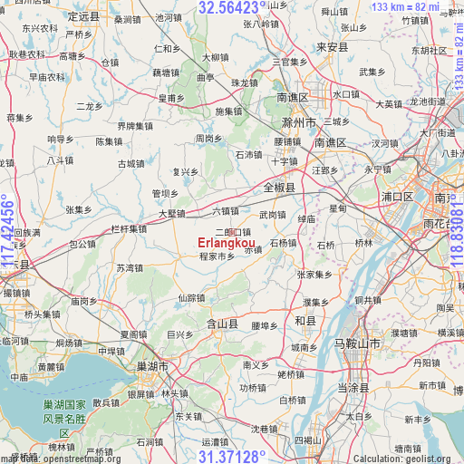
Erlangkou GPS coordinates[2]
31° 58' 10.884" North, 118° 7' 39.648" East
| Map corner | latitude | longitude |
|---|---|---|
| Upper-left | 32.56423°, | 117.42456° |
| Center: | 31.96969°, | 118.12768° |
| Lower-right: | 31.37128°, | 118.83081° |
| Map W x H: | 132.6×132.6 km | = 82.4×82.4mi |
| max Lat: | 53.31946° ⇑39% North |
| Erlangkou: | 31.96969° |
| min Lat: | ⇓61% South 18.22056° |
| min Long | Erlangkou | max Long |
| 75.07348° | 118.12768° | 134.28917° |
| W 71.1%⇐ | ⇒28.9% E |
Elevation
Elevation of Erlangkou is 33 m = 108 ft, and this is 451.8 m = 1482 ft below average elevation for this country.
| Max E: |
5622 m = 18445 ft | 76.7% |
| Avg. | 484.8 m = 1591 ft | |
| Erlangkou | 33 m = 108 ft | |
Min E: |
-3 m = -10 ft | 23.3% |
See also: China elevation on elevation.city.
Geographical zone
Erlangkou is located in North temperate zone (between Tropic of Cancer and the Arctic Circle). Distance of this Northern Tropic circle is 948.8 km =589.6 mi to South.| Distance of | km | miles | from Erlangkou |
|---|---|---|---|
| North Pole | 6452.4 | 4009.3 | to North |
| Arctic Circle | 3846.5 | 2390.1 | to North |
| Tropic Cancer | 948.8 | 589.6 | to South |
| Equator | 3554.7 | 2208.8 | to South |


Nearby cities:
15 places around Erlangkou: (largest is in red/bold)
• Chengjia
7.7 km =4.8 mi,  213°
213°
• Huanfeng
28.3 km =17.6 mi,  185°
185°
• Liyang
35.4 km =22 mi,  142°
142°
• Qiaolin
37.7 km =23.4 mi,  93°
93°
• Shanhou
10.9 km =6.8 mi,  165°
165°
• Shiqiao
27.5 km =17.1 mi,  97°
97°
• Shiyang
14.1 km =8.8 mi, 98°
• Tangquan
38.2 km =23.7 mi,  69°
69°
• Wujiang
33.5 km =20.8 mi,  110°
110°
• Xiangquan
21 km =13 mi,  121°
121°
• Xianzong
21.9 km =13.6 mi, 211°
• Xibu
25.9 km =16.1 mi,  145°
145°
• Xiexiang
17.9 km =11.1 mi, 205°
• Xingdian
30 km =18.6 mi,  75°
75°
• Zhangjiaji
26.3 km =16.3 mi, 116°
Sources, notices
• [Note1] Compared only with cities in China existing in our database
• [Src1] Map data: © OpenStreetMap contributors (CC-BY-SA)
• [Src2] Other city data from geonames.org with taken over terms of usage.
• [Src3] Geographical zone / Annual Mean Temperature by Robert A. Rohde @ Wikipedia
