Bejucal geodata
Bejucal (Mayabeque) is a seat of a second-order administrative division; located in Cuba in America/Havana (GMT-4) time zone. With population of 18,123 people, there are 116 cities with bigger population in this country. Compared to other cities in Cuba, 84.5% of cities are located further ↓South; 84.5% of cities are located further →East and 84.5% of cities have lower elevation than Bejucal. Note1


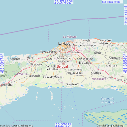
Bejucal GPS coordinates[2]
22° 55' 42.996" North, 82° 23' 18.996" West
| Map corner | latitude | longitude |
|---|---|---|
| Upper-left | 23.57462°, | -83.09174° |
| Center: | 22.92861°, | -82.38861° |
| Lower-right: | 22.2795°, | -81.68549° |
| Map W x H: | 144×144 km | = 89.5×89.5mi |
| max Lat: | 23.15917° ⇑15.5% North |
| Bejucal: | 22.92861° |
| min Lat: | ⇓84.5% South 19.90553° |
| min Long | Bejucal | max Long |
| -84.28599° | -82.38861° | -74.15181° |
| W 15.5%⇐ | ⇒84.5% E |
Elevation
Elevation of Bejucal is 110 m = 361 ft, and this is 41.4 m = 136 ft above average elevation for this country.
| Max E: |
761 m = 2497 ft | 15.5% |
| Bejucal | 110 m 361 ft | |
| Avg. | 68.6 m = 225 ft | |
Min E: |
3 m = 10 ft | 84.5% |
See also: Cuba elevation on elevation.city.
Geographical zone
Bejucal is located in North Torrid zone (between Equator and Tropic of Cancer). Distance of this Northern Tropic circle is 56.5 km =35.1 mi to North.| Distance of | km | miles | from Bejucal |
|---|---|---|---|
| North Pole | 7457.6 | 4633.9 | to North |
| Arctic Circle | 4851.8 | 3014.8 | to North |
| Tropic Cancer | 56.5 | 35.1 | to North |
| Equator | 2549.4 | 1584.1 | to South |


Nearby cities:
15 places around Bejucal: (largest is in red/bold)
• Arroyo Naranjo
12.2 km =7.6 mi,  9°
9°
• Bauta
17.3 km =10.7 mi,  290°
290°
• Boyeros
8.8 km =5.5 mi,  351°
351°
• Caimito
21.2 km =13.2 mi,  276°
276°
• Cerro
20 km =12.4 mi,  3°
3°
• Diez de Octubre
18 km =11.2 mi, 9°
• Güira de Melena
19.1 km =11.9 mi,  219°
219°
• Havana
22.7 km =14.1 mi, 1°
• La Habana Vieja
22.7 km =14.1 mi, 9°
• La Salud
7.2 km =4.5 mi,  209°
209°
• Quivicán
12.2 km =7.6 mi,  163°
163°
• Regla
22.6 km =14 mi, 14°
• San Antonio de los Baños
12.3 km =7.6 mi,  249°
249°
• San Miguel del Padrón
18.1 km =11.2 mi,  32°
32°
• Santiago de las Vegas
4.6 km =2.9 mi, 2°
Sources, notices
• [Note1] Compared only with cities in Cuba existing in our database
• [Src1] Map data: © OpenStreetMap contributors (CC-BY-SA)
• [Src2] Other city data from geonames.org with taken over terms of usage.
• [Src3] Geographical zone / Annual Mean Temperature by Robert A. Rohde @ Wikipedia
