Světlá pod Ještědem geodata
Světlá pod Ještědem (Liberecký kraj) is a populated place; located in Czech Republic in Europe/Prague (GMT+2) time zone. With population of 835 people, there are 1536 cities with bigger population in this country. Compared to other cities in Czech Republic, 97% of cities are located further ↓South; 62.5% of cities are located further →East and 90.3% of cities have lower elevation than Světlá pod Ještědem. Note1
Administrative division(s):
- Level 1: Liberecký kraj
- Level 2: Okres Liberec
- Level 3: Světlá pod Ještědem


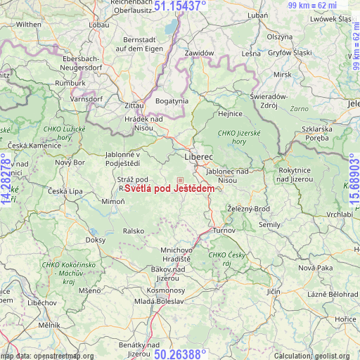
Světlá pod Ještědem GPS coordinates[2]
50° 42' 40.464" North, 14° 59' 9.24" East
| Map corner | latitude | longitude |
|---|---|---|
| Upper-left | 51.15437°, | 14.28278° |
| Center: | 50.71124°, | 14.9859° |
| Lower-right: | 50.26388°, | 15.68903° |
| Map W x H: | 99×99 km | = 61.5×61.5mi |
| max Lat: | 51.01104° ⇑3% North |
| Světlá pod Ještědem: | 50.71124° |
| min Lat: | ⇓97% South 48.60378° |
| min Long | Světlá pod Je | max Long |
| 12.17577° | 14.9859° | 18.82683° |
| W 37.5%⇐ | ⇒62.5% E |
Elevation
Elevation of Světlá pod Ještědem is 531 m = 1742 ft, and this is 179 m = 587 ft above average elevation for this country.
| Max E: |
901 m = 2956 ft | 9.7% |
| Světlá pod Ještědem | 531 m 1742 ft | |
| Avg. | 352 m = 1155 ft | |
Min E: |
136 m = 446 ft | 90.3% |
See also: Czech Republic elevation on elevation.city.
Geographical zone
Světlá pod Ještědem is located in North temperate zone (between Tropic of Cancer and the Arctic Circle). Distance of this North polar circle is 1762.6 km =1095.2 mi to North.| Distance of | km | miles | from Světlá pod Ještědem |
|---|---|---|---|
| North Pole | 4368.5 | 2714.5 | to North |
| Arctic Circle | 1762.6 | 1095.2 | to North |
| Tropic Cancer | 3032.6 | 1884.4 | to South |
| Equator | 5638.6 | 3503.7 | to South |


Nearby cities:
15 places around Světlá pod Ještědem: (largest is in red/bold)
• Bílá
6.2 km =3.9 mi,  145°
145°
• Bílý Kostel nad Nisou
13.2 km =8.2 mi,  340°
340°
• Chrastava
11.8 km =7.3 mi,  354°
354°
• Dlouhý Most
6.3 km =3.9 mi,  89°
89°
• Dubnice
12.6 km =7.8 mi,  277°
277°
• Hodkovice nad Mohelkou
8.9 km =5.5 mi,  124°
124°
• Jablonec nad Nisou
13.1 km =8.1 mi,  83°
83°
• Křižany
6.2 km =3.9 mi,  300°
300°
• Liberec
7.9 km =4.9 mi,  38°
38°
• Osečná
4.9 km =3 mi,  248°
248°
• Rádlo
9.3 km =5.8 mi,  98°
98°
• Stráž nad Nisou
9.3 km =5.8 mi,  17°
17°
• Stráž pod Ralskem
13.1 km =8.1 mi,  265°
265°
• Všelibice
7.6 km =4.7 mi,  198°
198°
• Český Dub
5.7 km =3.5 mi,  172°
172°
Sources, notices
• [Note1] Compared only with cities in Czech Republic existing in our database
• [Src1] Map data: © OpenStreetMap contributors (CC-BY-SA)
• [Src2] Other city data from geonames.org with taken over terms of usage.
• [Src3] Geographical zone / Annual Mean Temperature by Robert A. Rohde @ Wikipedia
