Bílý Kostel nad Nisou geodata
Bílý Kostel nad Nisou (Liberecký kraj) is a populated place; located in Czech Republic in Europe/Prague (GMT+2) time zone. With population of 811 people, there are 1584 cities with bigger population in this country. Compared to other cities in Czech Republic, 98.8% of cities are located further ↓South; 63.7% of cities are located further →East and 63.5% of cities have higher elevation than Bílý Kostel nad Nisou. Note1
Administrative division(s):
- Level 1: Liberecký kraj
- Level 2: Okres Liberec
- Level 3: Bílý Kostel nad Nisou
Current local time in Bílý Kostel nad Nisou:
05:43 AM, SaturdayDifference from your time zone: hours


Bílý Kostel nad Nisou GPS coordinates[2]
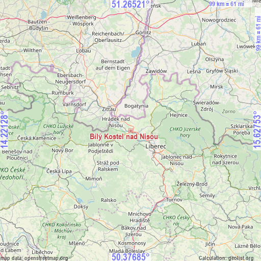
50° 49' 23.304" North, 14° 55' 27.84" East
| Map corner | latitude | longitude |
|---|---|---|
| Upper-left | 51.26521°, | 14.22128° |
| Center: | 50.82314°, | 14.9244° |
| Lower-right: | 50.37685°, | 15.62753° |
| Map W x H: | 98.8×98.8 km | = 61.4×61.4mi |
| max Lat: | 51.01104° ⇑1.2% North |
| Bílý Kostel nad Nisou: | 50.82314° |
| min Lat: | ⇓98.8% South 48.60378° |
| min Long | Bílý Kostel n | max Long |
| 12.17577° | 14.9244° | 18.82683° |
| W 36.3%⇐ | ⇒63.7% E |
Elevation
Elevation of Bílý Kostel nad Nisou is 279 m = 915 ft, and this is 73 m = 240 ft below average elevation for this country.
| Max E: |
901 m = 2956 ft | 63.5% |
| Avg. | 352 m = 1155 ft | |
| Bílý Kostel nad Nisou | 279 m = 915 ft | |
Min E: |
136 m = 446 ft | 36.5% |
See also: Czech Republic elevation on elevation.city.
Geographical zone
Bílý Kostel nad Nisou is located in North temperate zone (between Tropic of Cancer and the Arctic Circle). Distance of this North polar circle is 1750.2 km =1087.5 mi to North.| Distance of | km | miles | from Bílý Kostel nad Nisou |
|---|---|---|---|
| North Pole | 4356.1 | 2706.8 | to North |
| Arctic Circle | 1750.2 | 1087.5 | to North |
| Tropic Cancer | 3045.1 | 1892.1 | to South |
| Equator | 5651 | 3511.4 | to South |


Nearby cities:
15 places around Bílý Kostel nad Nisou: (largest is in red/bold)
• Chotyně
4.2 km =2.6 mi,  290°
290°
• Chrastava
3.2 km =2 mi,  102°
102°
• Dubnice
13.5 km =8.4 mi,  216°
216°
• Dětřichov
11 km =6.8 mi,  45°
45°
• Hrádek nad Nisou
6.5 km =4 mi,  300°
300°
• Jablonné v Podještědí
13.2 km =8.2 mi,  240°
240°
• Křižany
9.4 km =5.8 mi,  186°
186°
• Liberec
11.2 km =7 mi,  123°
123°
• Mníšek
9.3 km =5.8 mi,  84°
84°
• Nová Ves
5.5 km =3.4 mi, 80°
• Oldřichov v Hájích
11.6 km =7.2 mi, 75°
• Osečná
14.3 km =8.9 mi,  180°
180°
• Rynoltice
8.3 km =5.2 mi, 242°
• Stráž nad Nisou
8 km =5 mi, 116°
• Světlá pod Ještědem
13.2 km =8.2 mi,  160°
160°
Sources, notices
• [Note1] Compared only with cities in Czech Republic existing in our database
• [Src1] Map data: © OpenStreetMap contributors (CC-BY-SA)
• [Src2] Other city data from geonames.org with taken over terms of usage.
• [Src3] Geographical zone / Annual Mean Temperature by Robert A. Rohde @ Wikipedia
