Roztoky u Jilemnice geodata
Roztoky u Jilemnice (Liberecký kraj) is a populated place; located in Czech Republic in Europe/Prague (GMT+2) time zone. With population of 936 people, there are 1374 cities with bigger population in this country. Compared to other cities in Czech Republic, 92.5% of cities are located further ↓South; 52.9% of cities are located further →East and 73.4% of cities have lower elevation than Roztoky u Jilemnice. Note1
Administrative division(s):
- Level 1: Liberecký kraj
- Level 2: Okres Semily
- Level 3: Roztoky u Jilemnice


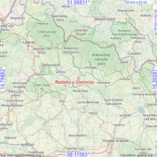
Roztoky u Jilemnice GPS coordinates[2]
50° 33' 49.644" North, 15° 29' 59.064" East
| Map corner | latitude | longitude |
|---|---|---|
| Upper-left | 51.00831°, | 14.79662° |
| Center: | 50.56379°, | 15.49974° |
| Lower-right: | 50.11503°, | 16.20287° |
| Map W x H: | 99.3×99.3 km | = 61.7×61.7mi |
| max Lat: | 51.01104° ⇑7.5% North |
| Roztoky u Jilemnice: | 50.56379° |
| min Lat: | ⇓92.5% South 48.60378° |
| min Long | Roztoky u Jilem | max Long |
| 12.17577° | 15.49974° | 18.82683° |
| W 47.1%⇐ | ⇒52.9% E |
Elevation
Elevation of Roztoky u Jilemnice is 431 m = 1414 ft, and this is 79 m = 259 ft above average elevation for this country.
| Max E: |
901 m = 2956 ft | 26.6% |
| Roztoky u Jilemnice | 431 m 1414 ft | |
| Avg. | 352 m = 1155 ft | |
Min E: |
136 m = 446 ft | 73.4% |
See also: Czech Republic elevation on elevation.city.
Geographical zone
Roztoky u Jilemnice is located in North temperate zone (between Tropic of Cancer and the Arctic Circle). Distance of this North polar circle is 1779 km =1105.4 mi to North.| Distance of | km | miles | from Roztoky u Jilemnice |
|---|---|---|---|
| North Pole | 4384.9 | 2724.6 | to North |
| Arctic Circle | 1779 | 1105.4 | to North |
| Tropic Cancer | 3016.2 | 1874.2 | to South |
| Equator | 5622.2 | 3493.5 | to South |


Nearby cities:
15 places around Roztoky u Jilemnice: (largest is in red/bold)
• Benešov u Semil
10.3 km =6.4 mi,  295°
295°
• Dolní Branná
7.4 km =4.6 mi,  63°
63°
• Dolní Kalná
10.2 km =6.3 mi,  105°
105°
• Horní Branná
7.1 km =4.4 mi,  45°
45°
• Jilemnice
5 km =3.1 mi,  5°
5°
• Košťálov
6.8 km =4.2 mi,  277°
277°
• Libštát
5.9 km =3.7 mi,  265°
265°
• Lomnice nad Popelkou
9.7 km =6 mi,  247°
247°
• Nová Paka
7.8 km =4.8 mi,  172°
172°
• Nová Ves nad Popelkou
7.9 km =4.9 mi,  232°
232°
• Stará Paka
6 km =3.7 mi,  183°
183°
• Stružinec
10.1 km =6.3 mi,  261°
261°
• Studenec
3.7 km =2.3 mi, 108°
• Valdice
6.5 km =4 mi,  289°
289°
• Víchová nad Jizerou
7.4 km =4.6 mi,  353°
353°
Sources, notices
• [Note1] Compared only with cities in Czech Republic existing in our database
• [Src1] Map data: © OpenStreetMap contributors (CC-BY-SA)
• [Src2] Other city data from geonames.org with taken over terms of usage.
• [Src3] Geographical zone / Annual Mean Temperature by Robert A. Rohde @ Wikipedia
