Dolní Branná geodata
Dolní Branná (Královéhradecký kraj) is a populated place; located in Czech Republic in Europe/Prague (GMT+2) time zone. With population of 938 people, there are 1368 cities with bigger population in this country. Compared to other cities in Czech Republic, 93.4% of cities are located further ↓South; 51.7% of cities are located further →East and 74% of cities have lower elevation than Dolní Branná. Note1
Administrative division(s):
- Level 1: Královéhradecký kraj
- Level 2: Okres Trutnov
- Level 3: Dolní Branná


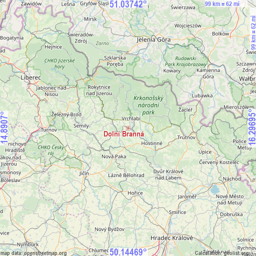
Dolní Branná GPS coordinates[2]
50° 35' 35.412" North, 15° 35' 37.752" East
| Map corner | latitude | longitude |
|---|---|---|
| Upper-left | 51.03742°, | 14.8907° |
| Center: | 50.59317°, | 15.59382° |
| Lower-right: | 50.14469°, | 16.29695° |
| Map W x H: | 99.3×99.3 km | = 61.7×61.7mi |
| max Lat: | 51.01104° ⇑6.6% North |
| Dolní Branná: | 50.59317° |
| min Lat: | ⇓93.4% South 48.60378° |
| min Long | Dolní Branná | max Long |
| 12.17577° | 15.59382° | 18.82683° |
| W 48.3%⇐ | ⇒51.7% E |
Elevation
Elevation of Dolní Branná is 434 m = 1424 ft, and this is 82 m = 269 ft above average elevation for this country.
| Max E: |
901 m = 2956 ft | 26% |
| Dolní Branná | 434 m 1424 ft | |
| Avg. | 352 m = 1155 ft | |
Min E: |
136 m = 446 ft | 74% |
See also: Czech Republic elevation on elevation.city.
Geographical zone
Dolní Branná is located in North temperate zone (between Tropic of Cancer and the Arctic Circle). Distance of this North polar circle is 1775.7 km =1103.4 mi to North.| Distance of | km | miles | from Dolní Branná |
|---|---|---|---|
| North Pole | 4381.6 | 2722.6 | to North |
| Arctic Circle | 1775.7 | 1103.4 | to North |
| Tropic Cancer | 3019.5 | 1876.2 | to South |
| Equator | 5625.4 | 3495.5 | to South |


Nearby cities:
15 places around Dolní Branná: (largest is in red/bold)
• Benecko
8.7 km =5.4 mi,  338°
338°
• Dolní Kalná
6.8 km =4.2 mi,  152°
152°
• Dolní Lánov
5 km =3.1 mi,  97°
97°
• Horní Branná
2.3 km =1.4 mi,  316°
316°
• Hostinné
10.9 km =6.8 mi,  122°
122°
• Jilemnice
6.4 km =4 mi,  285°
285°
• Poniklá
11.9 km =7.4 mi,  309°
309°
• Prosečné
7.5 km =4.7 mi, 117°
• Roztoky u Jilemnice
7.4 km =4.6 mi,  243°
243°
• Rudník
9.9 km =6.2 mi,  88°
88°
• Stará Paka
11.6 km =7.2 mi,  217°
217°
• Studenec
5.4 km =3.4 mi, 215°
• Vrchlabí
3.9 km =2.4 mi,  16°
16°
• Víchová nad Jizerou
8.5 km =5.3 mi,  298°
298°
• Černý Důl
9.5 km =5.9 mi,  60°
60°
Sources, notices
• [Note1] Compared only with cities in Czech Republic existing in our database
• [Src1] Map data: © OpenStreetMap contributors (CC-BY-SA)
• [Src2] Other city data from geonames.org with taken over terms of usage.
• [Src3] Geographical zone / Annual Mean Temperature by Robert A. Rohde @ Wikipedia
