Razová geodata
Razová (Moravskoslezský) is a populated place; located in Czech Republic in Europe/Prague (GMT+2) time zone. With population of 523 people, there are 2408 cities with bigger population in this country. Compared to other cities in Czech Republic, 60.8% of cities are located further ↓South; 85.8% of cities are located further ←West and 92.7% of cities have lower elevation than Razová. Note1


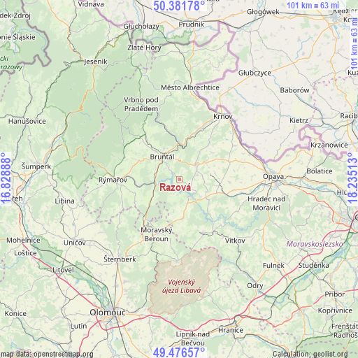
Razová GPS coordinates[2]
49° 55' 52.68" North, 17° 31' 55.2" East
| Map corner | latitude | longitude |
|---|---|---|
| Upper-left | 50.38178°, | 16.82888° |
| Center: | 49.9313°, | 17.532° |
| Lower-right: | 49.47657°, | 18.23513° |
| Map W x H: | 100.6×100.6 km | = 62.5×62.5mi |
| max Lat: | 51.01104° ⇑39.2% North |
| Razová: | 49.9313° |
| min Lat: | ⇓60.8% South 48.60378° |
| min Long | Razová | max Long |
| 12.17577° | 17.532° | 18.82683° |
| W 85.8%⇐ | ⇒14.2% E |
Elevation
Elevation of Razová is 554 m = 1818 ft, and this is 202 m = 663 ft above average elevation for this country.
| Max E: |
901 m = 2956 ft | 7.3% |
| Razová | 554 m 1818 ft | |
| Avg. | 352 m = 1155 ft | |
Min E: |
136 m = 446 ft | 92.7% |
See also: Czech Republic elevation on elevation.city.
Geographical zone
Razová is located in North temperate zone (between Tropic of Cancer and the Arctic Circle). Distance of this North polar circle is 1849.3 km =1149.1 mi to North.| Distance of | km | miles | from Razová |
|---|---|---|---|
| North Pole | 4455.2 | 2768.3 | to North |
| Arctic Circle | 1849.3 | 1149.1 | to North |
| Tropic Cancer | 2945.9 | 1830.5 | to South |
| Equator | 5551.8 | 3449.7 | to South |


Nearby cities:
15 places around Razová: (largest is in red/bold)
• Bruntál
8 km =5 mi,  322°
322°
• Břidličná
11.7 km =7.3 mi,  259°
259°
• Dvorce
11 km =6.8 mi,  174°
174°
• Hlavnice
14 km =8.7 mi,  93°
93°
• Horní Benešov
6.4 km =4 mi,  51°
51°
• Jakartovice
11 km =6.8 mi,  99°
99°
• Lichnov
10.9 km =6.8 mi,  38°
38°
• Litultovice
16 km =9.9 mi, 100°
• Lomnice
10.7 km =6.6 mi,  231°
231°
• Ryžoviště
13.9 km =8.6 mi,  243°
243°
• Staré Město
10.8 km =6.7 mi, 318°
• Svobodné Heřmanice
10.3 km =6.4 mi,  80°
80°
• Velké Heraltice
14.9 km =9.3 mi,  70°
70°
• Zátor
12.2 km =7.6 mi,  20°
20°
• Široká Niva
15.3 km =9.5 mi,  346°
346°
Sources, notices
• [Note1] Compared only with cities in Czech Republic existing in our database
• [Src1] Map data: © OpenStreetMap contributors (CC-BY-SA)
• [Src2] Other city data from geonames.org with taken over terms of usage.
• [Src3] Geographical zone / Annual Mean Temperature by Robert A. Rohde @ Wikipedia
