Podhradní Lhota geodata
Podhradní Lhota (Zlín) is a populated place; located in Czech Republic in Europe/Prague (GMT+2) time zone. With population of 529 people, there are 2386 cities with bigger population in this country. Compared to other cities in Czech Republic, 69.9% of cities are located further ↑North; 89.9% of cities are located further ←West and 61.6% of cities have lower elevation than Podhradní Lhota. Note1


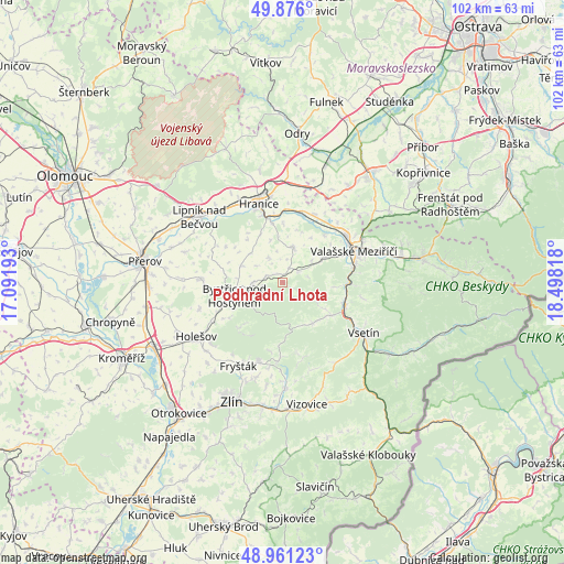
Podhradní Lhota GPS coordinates[2]
49° 25' 14.7" North, 17° 47' 42.18" East
| Map corner | latitude | longitude |
|---|---|---|
| Upper-left | 49.876°, | 17.09193° |
| Center: | 49.42075°, | 17.79505° |
| Lower-right: | 48.96123°, | 18.49818° |
| Map W x H: | 101.7×101.7 km | = 63.2×63.2mi |
| max Lat: | 51.01104° ⇑69.9% North |
| Podhradní Lhota: | 49.42075° |
| min Lat: | ⇓30.1% South 48.60378° |
| min Long | Podhradní Lhot | max Long |
| 12.17577° | 17.79505° | 18.82683° |
| W 89.9%⇐ | ⇒10.1% E |
Elevation
Elevation of Podhradní Lhota is 383 m = 1257 ft, and this is 31 m = 102 ft above average elevation for this country.
| Max E: |
901 m = 2956 ft | 38.4% |
| Podhradní Lhota | 383 m 1257 ft | |
| Avg. | 352 m = 1155 ft | |
Min E: |
136 m = 446 ft | 61.6% |
See also: Czech Republic elevation on elevation.city.
Geographical zone
Podhradní Lhota is located in North temperate zone (between Tropic of Cancer and the Arctic Circle). Distance of this North polar circle is 1906.1 km =1184.4 mi to North.| Distance of | km | miles | from Podhradní Lhota |
|---|---|---|---|
| North Pole | 4512 | 2803.6 | to North |
| Arctic Circle | 1906.1 | 1184.4 | to North |
| Tropic Cancer | 2889.2 | 1795.3 | to South |
| Equator | 5495.1 | 3414.5 | to South |


Nearby cities:
15 places around Podhradní Lhota: (largest is in red/bold)
• Branky
8.4 km =5.2 mi,  57°
57°
• Bystřice pod Hostýnem
9.1 km =5.7 mi,  254°
254°
• Chvalčov
7 km =4.3 mi,  239°
239°
• Hošťálková
9.1 km =5.7 mi,  143°
143°
• Kateřinice
7.8 km =4.8 mi,  123°
123°
• Kelč
6.6 km =4.1 mi,  12°
12°
• Kunovice
2.8 km =1.7 mi,  22°
22°
• Loukov
5.4 km =3.4 mi,  271°
271°
• Loučka
3.4 km =2.1 mi,  53°
53°
• Mikulůvka
9.4 km =5.8 mi,  94°
94°
• Opatovice
9.6 km =6 mi,  335°
335°
• Police
6.6 km =4.1 mi, 52°
• Skalička
10.5 km =6.5 mi,  0°
0°
• Slavkov pod Hostýnem
10.2 km =6.3 mi, 241°
• Všechovice
5.4 km =3.4 mi,  330°
330°
Sources, notices
• [Note1] Compared only with cities in Czech Republic existing in our database
• [Src1] Map data: © OpenStreetMap contributors (CC-BY-SA)
• [Src2] Other city data from geonames.org with taken over terms of usage.
• [Src3] Geographical zone / Annual Mean Temperature by Robert A. Rohde @ Wikipedia
