Pec pod Sněžkou geodata
Pec pod Sněžkou (Královéhradecký kraj) is a populated place; located in Czech Republic in Europe/Prague (GMT+2) time zone. With population of 608 people, there are 2098 cities with bigger population in this country. Compared to other cities in Czech Republic, 96.5% of cities are located further ↓South; 50.5% of cities are located further ←West and 99.7% of cities have lower elevation than Pec pod Sněžkou. Note1
Administrative division(s):
- Level 1: Královéhradecký kraj
- Level 2: Okres Trutnov
- Level 3: Pec pod Sněžkou


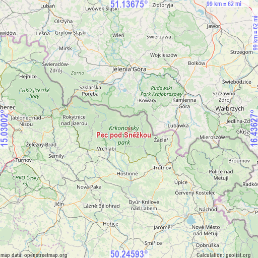
Pec pod Sněžkou GPS coordinates[2]
50° 41' 36.42" North, 15° 43' 59.304" East
| Map corner | latitude | longitude |
|---|---|---|
| Upper-left | 51.13675°, | 15.03002° |
| Center: | 50.69345°, | 15.73314° |
| Lower-right: | 50.24593°, | 16.43627° |
| Map W x H: | 99×99 km | = 61.5×61.5mi |
| max Lat: | 51.01104° ⇑3.5% North |
| Pec pod Sněžkou: | 50.69345° |
| min Lat: | ⇓96.5% South 48.60378° |
| min Long | Pec pod Sněžk | max Long |
| 12.17577° | 15.73314° | 18.82683° |
| W 50.5%⇐ | ⇒49.5% E |
Elevation
Elevation of Pec pod Sněžkou is 788 m = 2585 ft, and this is 436 m = 1430 ft above average elevation for this country.
| Max E: |
901 m = 2956 ft | 0.3% |
| Pec pod Sněžkou | 788 m 2585 ft | |
| Avg. | 352 m = 1155 ft | |
Min E: |
136 m = 446 ft | 99.7% |
See also: Czech Republic elevation on elevation.city.
Geographical zone
Pec pod Sněžkou is located in North temperate zone (between Tropic of Cancer and the Arctic Circle). Distance of this North polar circle is 1764.6 km =1096.5 mi to North.| Distance of | km | miles | from Pec pod Sněžkou |
|---|---|---|---|
| North Pole | 4370.5 | 2715.7 | to North |
| Arctic Circle | 1764.6 | 1096.5 | to North |
| Tropic Cancer | 3030.7 | 1883.2 | to South |
| Equator | 5636.6 | 3502.4 | to South |


Nearby cities:
15 places around Pec pod Sněžkou: (largest is in red/bold)
• Benecko
13.4 km =8.3 mi,  256°
256°
• Bernartice
17.3 km =10.7 mi,  108°
108°
• Dolní Branná
14.9 km =9.3 mi,  221°
221°
• Dolní Lánov
12.8 km =8 mi,  202°
202°
• Horní Branná
14.8 km =9.2 mi,  230°
230°
• Hostinné
17 km =10.6 mi,  182°
182°
• Janské Lázně
7.7 km =4.8 mi,  153°
153°
• Mladé Buky
12 km =7.5 mi,  143°
143°
• Prosečné
15 km =9.3 mi,  192°
192°
• Rudník
10.9 km =6.8 mi, 179°
• Svoboda nad Úpou
9.5 km =5.9 mi, 141°
• Vrchlabí
11.4 km =7.1 mi, 229°
• Černý Důl
6.7 km =4.2 mi, 193°
• Špindlerův Mlýn
9.4 km =5.8 mi,  292°
292°
• Žacléř
12.9 km =8 mi, 105°
Sources, notices
• [Note1] Compared only with cities in Czech Republic existing in our database
• [Src1] Map data: © OpenStreetMap contributors (CC-BY-SA)
• [Src2] Other city data from geonames.org with taken over terms of usage.
• [Src3] Geographical zone / Annual Mean Temperature by Robert A. Rohde @ Wikipedia
