Ostrov u Macochy geodata
Ostrov u Macochy (South Moravian) is a populated place; located in Czech Republic in Europe/Prague (GMT+2) time zone. With population of 1,078 people, there are 1203 cities with bigger population in this country. Compared to other cities in Czech Republic, 72% of cities are located further ↑North; 70.5% of cities are located further ←West and 86.2% of cities have lower elevation than Ostrov u Macochy. Note1
Administrative division(s):
- Level 1: South Moravian
- Level 2: Okres Blansko
- Level 3: Ostrov u Macochy


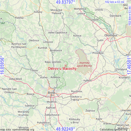
Ostrov u Macochy GPS coordinates[2]
49° 22' 56.496" North, 16° 45' 45.648" East
| Map corner | latitude | longitude |
|---|---|---|
| Upper-left | 49.83797°, | 16.05956° |
| Center: | 49.38236°, | 16.76268° |
| Lower-right: | 48.92249°, | 17.46581° |
| Map W x H: | 101.8×101.8 km | = 63.3×63.3mi |
| max Lat: | 51.01104° ⇑72% North |
| Ostrov u Macochy: | 49.38236° |
| min Lat: | ⇓28% South 48.60378° |
| min Long | Ostrov u Macoch | max Long |
| 12.17577° | 16.76268° | 18.82683° |
| W 70.5%⇐ | ⇒29.5% E |
Elevation
Elevation of Ostrov u Macochy is 503 m = 1650 ft, and this is 151 m = 495 ft above average elevation for this country.
| Max E: |
901 m = 2956 ft | 13.8% |
| Ostrov u Macochy | 503 m 1650 ft | |
| Avg. | 352 m = 1155 ft | |
Min E: |
136 m = 446 ft | 86.2% |
See also: Czech Republic elevation on elevation.city.
Geographical zone
Ostrov u Macochy is located in North temperate zone (between Tropic of Cancer and the Arctic Circle). Distance of this North polar circle is 1910.4 km =1187.1 mi to North.| Distance of | km | miles | from Ostrov u Macochy |
|---|---|---|---|
| North Pole | 4516.3 | 2806.3 | to North |
| Arctic Circle | 1910.4 | 1187.1 | to North |
| Tropic Cancer | 2884.9 | 1792.6 | to South |
| Equator | 5490.8 | 3411.8 | to South |


Nearby cities:
15 places around Ostrov u Macochy: (largest is in red/bold)
• Blansko
8.8 km =5.5 mi,  255°
255°
• Jedovnice
4.2 km =2.6 mi,  186°
186°
• Kotvrdovice
3.4 km =2.1 mi,  152°
152°
• Lažánky
5.2 km =3.2 mi,  227°
227°
• Lipovec
3.1 km =1.9 mi,  86°
86°
• Olomučany
8.7 km =5.4 mi, 229°
• Rozstání
5.9 km =3.7 mi,  73°
73°
• Rudice
5.7 km =3.5 mi,  207°
207°
• Ruprechtov
8.8 km =5.5 mi,  132°
132°
• Rájec-Jestřebí
9.5 km =5.9 mi,  289°
289°
• Ráječko
8.6 km =5.3 mi,  278°
278°
• Senetářov
4.3 km =2.7 mi,  135°
135°
• Sloup
4 km =2.5 mi,  335°
335°
• Vavřinec
3.8 km =2.4 mi,  305°
305°
• Šošůvka
3.2 km =2 mi,  345°
345°
Sources, notices
• [Note1] Compared only with cities in Czech Republic existing in our database
• [Src1] Map data: © OpenStreetMap contributors (CC-BY-SA)
• [Src2] Other city data from geonames.org with taken over terms of usage.
• [Src3] Geographical zone / Annual Mean Temperature by Robert A. Rohde @ Wikipedia
