Hejnice geodata
Hejnice (Liberecký kraj) is a populated place; located in Czech Republic in Europe/Prague (GMT+2) time zone. With population of 2,751 people, there are 482 cities with bigger population in this country. Compared to other cities in Czech Republic, 99.1% of cities are located further ↓South; 59% of cities are located further →East and 60.2% of cities have lower elevation than Hejnice. Note1


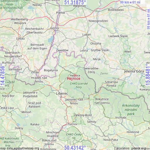
Hejnice GPS coordinates[2]
50° 52' 37.92" North, 15° 10' 54.048" East
| Map corner | latitude | longitude |
|---|---|---|
| Upper-left | 51.31875°, | 14.47856° |
| Center: | 50.8772°, | 15.18168° |
| Lower-right: | 50.43142°, | 15.88481° |
| Map W x H: | 98.7×98.7 km | = 61.3×61.3mi |
| max Lat: | 51.01104° ⇑0.9% North |
| Hejnice: | 50.8772° |
| min Lat: | ⇓99.1% South 48.60378° |
| min Long | Hejnice | max Long |
| 12.17577° | 15.18168° | 18.82683° |
| W 41%⇐ | ⇒59% E |
Elevation
Elevation of Hejnice is 377 m = 1237 ft, and this is 25 m = 82 ft above average elevation for this country.
| Max E: |
901 m = 2956 ft | 39.8% |
| Hejnice | 377 m 1237 ft | |
| Avg. | 352 m = 1155 ft | |
Min E: |
136 m = 446 ft | 60.2% |
See also: Czech Republic elevation on elevation.city.
Geographical zone
Hejnice is located in North temperate zone (between Tropic of Cancer and the Arctic Circle). Distance of this North polar circle is 1744.2 km =1083.8 mi to North.| Distance of | km | miles | from Hejnice |
|---|---|---|---|
| North Pole | 4350 | 2703 | to North |
| Arctic Circle | 1744.2 | 1083.8 | to North |
| Tropic Cancer | 3051.1 | 1895.9 | to South |
| Equator | 5657 | 3515.1 | to South |


Nearby cities:
15 places around Hejnice: (largest is in red/bold)
• Bulovka
11.2 km =7 mi,  338°
338°
• Bílý Potok
2.9 km =1.8 mi,  97°
97°
• Dolní Řasnice
7.7 km =4.8 mi,  353°
353°
• Dětřichov
10.3 km =6.4 mi,  279°
279°
• Frýdlant
8.7 km =5.4 mi,  304°
304°
• Janov nad Nisou
11.7 km =7.3 mi,  184°
184°
• Jindřichovice pod Smrkem
10.4 km =6.5 mi,  27°
27°
• Jiřetín pod Bukovou
14.7 km =9.1 mi,  157°
157°
• Josefův Důl
11.2 km =7 mi, 161°
• Mníšek
10.2 km =6.3 mi,  240°
240°
• Nová Ves
13.7 km =8.5 mi,  248°
248°
• Nové Město pod Smrkem
6.3 km =3.9 mi, 32°
• Oldřichov v Hájích
7.5 km =4.7 mi, 245°
• Raspenava
5.6 km =3.5 mi, 302°
• Stráž nad Nisou
14.5 km =9 mi,  228°
228°
Sources, notices
• [Note1] Compared only with cities in Czech Republic existing in our database
• [Src1] Map data: © OpenStreetMap contributors (CC-BY-SA)
• [Src2] Other city data from geonames.org with taken over terms of usage.
• [Src3] Geographical zone / Annual Mean Temperature by Robert A. Rohde @ Wikipedia
