Česká Bělá geodata
Česká Bělá (Vysočina) is a populated place; located in Czech Republic in Europe/Prague (GMT+2) time zone. With population of 947 people, there are 1360 cities with bigger population in this country. Compared to other cities in Czech Republic, 57.2% of cities are located further ↑North; 50.2% of cities are located further →East and 88.9% of cities have lower elevation than Česká Bělá. Note1


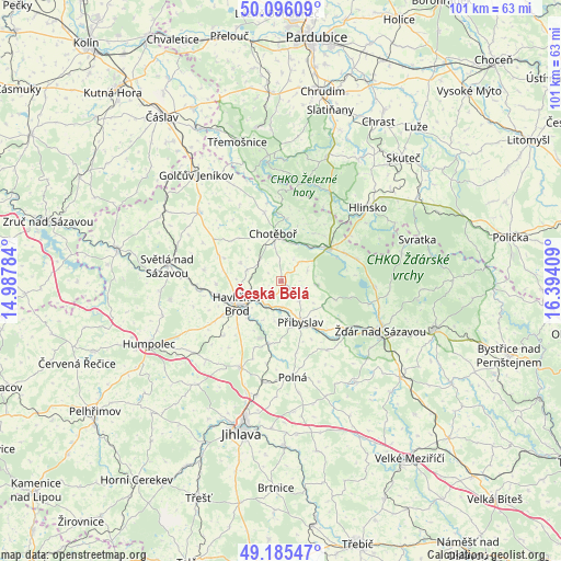
Česká Bělá GPS coordinates[2]
49° 38' 34.476" North, 15° 41' 27.456" East
| Map corner | latitude | longitude |
|---|---|---|
| Upper-left | 50.09609°, | 14.98784° |
| Center: | 49.64291°, | 15.69096° |
| Lower-right: | 49.18547°, | 16.39409° |
| Map W x H: | 101.3×101.2 km | = 62.9×62.9mi |
| max Lat: | 51.01104° ⇑57.2% North |
| Česká Bělá: | 49.64291° |
| min Lat: | ⇓42.8% South 48.60378° |
| min Long | Česká Bělá | max Long |
| 12.17577° | 15.69096° | 18.82683° |
| W 49.8%⇐ | ⇒50.2% E |
Elevation
Elevation of Česká Bělá is 523 m = 1716 ft, and this is 171 m = 561 ft above average elevation for this country.
| Max E: |
901 m = 2956 ft | 11.1% |
| Česká Bělá | 523 m 1716 ft | |
| Avg. | 352 m = 1155 ft | |
Min E: |
136 m = 446 ft | 88.9% |
See also: Czech Republic elevation on elevation.city.
Geographical zone
Česká Bělá is located in North temperate zone (between Tropic of Cancer and the Arctic Circle). Distance of this North polar circle is 1881.4 km =1169 mi to North.| Distance of | km | miles | from Česká Bělá |
|---|---|---|---|
| North Pole | 4487.3 | 2788.3 | to North |
| Arctic Circle | 1881.4 | 1169 | to North |
| Tropic Cancer | 2913.9 | 1810.6 | to South |
| Equator | 5519.8 | 3429.8 | to South |


Nearby cities:
15 places around Česká Bělá: (largest is in red/bold)
• Chotěboř
8.8 km =5.5 mi,  350°
350°
• Havlíčkova Borová
6.6 km =4.1 mi,  96°
96°
• Havlíčkův Brod
9 km =5.6 mi,  243°
243°
• Křížová
12.7 km =7.9 mi,  66°
66°
• Libice nad Doubravou
11.4 km =7.1 mi,  4°
4°
• Lučice
14.2 km =8.8 mi,  278°
278°
• Lípa
14.4 km =8.9 mi,  226°
226°
• Maleč
14.4 km =8.9 mi,  355°
355°
• Okrouhlice
14.5 km =9 mi,  264°
264°
• Pohled
5.3 km =3.3 mi,  215°
215°
• Přibyslav
8.1 km =5 mi,  154°
154°
• Rozsochatec
5.3 km =3.3 mi,  308°
308°
• Velká Losenice
12.6 km =7.8 mi,  123°
123°
• Vojnův Městec
14.1 km =8.8 mi, 73°
• Šlapanov
11.4 km =7.1 mi,  192°
192°
Sources, notices
• [Note1] Compared only with cities in Czech Republic existing in our database
• [Src1] Map data: © OpenStreetMap contributors (CC-BY-SA)
• [Src2] Other city data from geonames.org with taken over terms of usage.
• [Src3] Geographical zone / Annual Mean Temperature by Robert A. Rohde @ Wikipedia
