Wittenförden geodata
Wittenförden (Mecklenburg-Vorpommern) is a populated place; located in Germany in Europe/Berlin (GMT+2) time zone. With population of 2,931 people, there are 4064 cities with bigger population in this country. Compared to other cities in Germany, 87.4% of cities are located further ↓South; 71.7% of cities are located further ←West and 74.1% of cities have higher elevation than Wittenförden. Note1
Administrative division(s):
- Level 1: Mecklenburg-Vorpommern
- Level 3: Ludwigslust-Parchim
- Level 4: Wittenförden


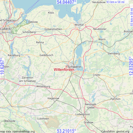
Wittenförden GPS coordinates[2]
53° 37' 45.012" North, 11° 19' 47.352" East
| Map corner | latitude | longitude |
|---|---|---|
| Upper-left | 54.04407°, | 10.6267° |
| Center: | 53.62917°, | 11.32982° |
| Lower-right: | 53.21015°, | 12.03295° |
| Map W x H: | 92.7×92.7 km | = 57.6×57.6mi |
| max Lat: | 55.01917° ⇑12.6% North |
| Wittenförden: | 53.62917° |
| min Lat: | ⇓87.4% South 47.40724° |
| min Long | Wittenförden | max Long |
| 5.92978° | 11.32982° | 14.98853° |
| W 71.7%⇐ | ⇒28.3% E |
Elevation
Elevation of Wittenförden is 67 m = 220 ft, and this is 182.1 m = 597 ft below average elevation for this country.
| Max E: |
1256 m = 4121 ft | 74.1% |
| Avg. | 249.1 m = 817 ft | |
| Wittenförden | 67 m = 220 ft | |
Min E: |
-5 m = -16 ft | 25.9% |
See also: Germany elevation on elevation.city.
Geographical zone
Wittenförden is located in North temperate zone (between Tropic of Cancer and the Arctic Circle). Distance of this North polar circle is 1438.2 km =893.7 mi to North.| Distance of | km | miles | from Wittenförden |
|---|---|---|---|
| North Pole | 4044.1 | 2512.9 | to North |
| Arctic Circle | 1438.2 | 893.7 | to North |
| Tropic Cancer | 3357.1 | 2086 | to South |
| Equator | 5963 | 3705.2 | to South |


Nearby cities:
15 places around Wittenförden: (largest is in red/bold)
• Altstadt
5.7 km =3.5 mi,  91°
91°
• Brüsewitz
7.7 km =4.8 mi,  312°
312°
• Feldstadt
5.1 km =3.2 mi,  97°
97°
• Gottesgabe
5.3 km =3.3 mi,  272°
272°
• Klein Rogahn
2.9 km =1.8 mi,  158°
158°
• Lankow
3.5 km =2.2 mi,  48°
48°
• Lewenberg
5.5 km =3.4 mi,  70°
70°
• Neumühle
2.7 km =1.7 mi,  84°
84°
• Paulsstadt
4.9 km =3 mi, 85°
• Pingelshagen
6 km =3.7 mi,  3°
3°
• Schelfstadt
5.8 km =3.6 mi, 84°
• Schwerin
5.5 km =3.4 mi, 89°
• Stralendorf
6.3 km =3.9 mi,  196°
196°
• Werdervorstadt
6.5 km =4 mi, 80°
• Weststadt
4.4 km =2.7 mi, 81°
Sources, notices
• [Note1] Compared only with cities in Germany existing in our database
• [Src1] Map data: © OpenStreetMap contributors (CC-BY-SA)
• [Src2] Other city data from geonames.org with taken over terms of usage.
• [Src3] Geographical zone / Annual Mean Temperature by Robert A. Rohde @ Wikipedia
