Weitersborn geodata
Weitersborn (Rheinland-Pfalz) is a seat of a fourth-order administrative division; located in Germany in Europe/Berlin (GMT+2) time zone. With population of 256 people, there are 10232 cities with bigger population in this country. Compared to other cities in Germany, 67.8% of cities are located further ↑North; 86.4% of cities are located further →East and 75.1% of cities have lower elevation than Weitersborn. Note1
Administrative division(s):
- Level 1: Rheinland-Pfalz
- Level 3: Landkreis Bad Kreuznach
- Level 4: Weitersborn


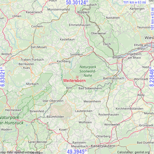
Weitersborn GPS coordinates[2]
49° 51' 0" North, 7° 31' 59.988" East
| Map corner | latitude | longitude |
|---|---|---|
| Upper-left | 50.30124°, | 6.83021° |
| Center: | 49.85°, | 7.53333° |
| Lower-right: | 49.3945°, | 8.23646° |
| Map W x H: | 100.8×100.8 km | = 62.6×62.6mi |
| max Lat: | 55.01917° ⇑67.8% North |
| Weitersborn: | 49.85° |
| min Lat: | ⇓32.2% South 47.40724° |
| min Long | Weitersborn | max Long |
| 5.92978° | 7.53333° | 14.98853° |
| W 13.6%⇐ | ⇒86.4% E |
Elevation
Elevation of Weitersborn is 398 m = 1306 ft, and this is 148.9 m = 489 ft above average elevation for this country.
| Max E: |
1256 m = 4121 ft | 24.9% |
| Weitersborn | 398 m 1306 ft | |
| Avg. | 249.1 m = 817 ft | |
Min E: |
-5 m = -16 ft | 75.1% |
See also: Germany elevation on elevation.city.
Geographical zone
Weitersborn is located in North temperate zone (between Tropic of Cancer and the Arctic Circle). Distance of this North polar circle is 1858.4 km =1154.8 mi to North.| Distance of | km | miles | from Weitersborn |
|---|---|---|---|
| North Pole | 4464.3 | 2774 | to North |
| Arctic Circle | 1858.4 | 1154.8 | to North |
| Tropic Cancer | 2936.9 | 1824.9 | to South |
| Equator | 5542.8 | 3444.1 | to South |


Nearby cities:
15 places around Weitersborn: (largest is in red/bold)
• Auen
5.1 km =3.2 mi,  111°
111°
• Brauweiler
4.4 km =2.7 mi,  212°
212°
• Gehlweiler
6 km =3.7 mi,  307°
307°
• Gemünden
6.4 km =4 mi,  321°
321°
• Heinzenberg
5.2 km =3.2 mi,  224°
224°
• Henau
3 km =1.9 mi, 307°
• Hochstetten-Dhaun
6.1 km =3.8 mi,  203°
203°
• Horbach
3.9 km =2.4 mi, 197°
• Kellenbach
3.6 km =2.2 mi,  270°
270°
• Königsau
3.6 km =2.2 mi, 270°
• Langenthal
3 km =1.9 mi,  127°
127°
• Martinstein
5.3 km =3.3 mi,  171°
171°
• Schwarzerden
1.2 km =0.7 mi, 270°
• Seesbach
1.1 km =0.7 mi,  118°
118°
• Simmertal
4.5 km =2.8 mi,  189°
189°
Sources, notices
• [Note1] Compared only with cities in Germany existing in our database
• [Src1] Map data: © OpenStreetMap contributors (CC-BY-SA)
• [Src2] Other city data from geonames.org with taken over terms of usage.
• [Src3] Geographical zone / Annual Mean Temperature by Robert A. Rohde @ Wikipedia
