Walsdorf geodata
Walsdorf (Rheinland-Pfalz) is a seat of a fourth-order administrative division; located in Germany in Europe/Berlin (GMT+2) time zone. With population of 876 people, there are 7612 cities with bigger population in this country. Compared to other cities in Germany, 57.2% of cities are located further ↑North; 96.3% of cities are located further →East and 85.3% of cities have lower elevation than Walsdorf. Note1


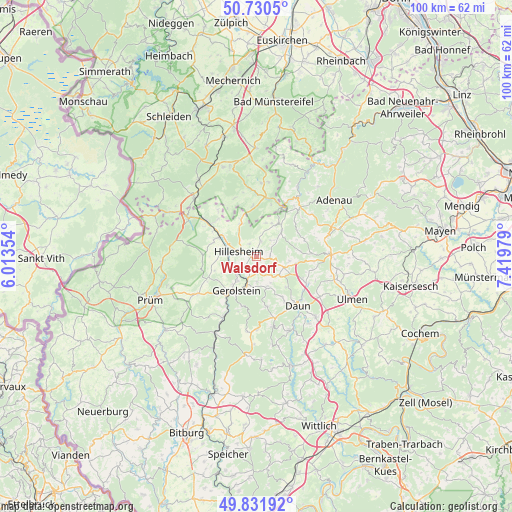
Walsdorf GPS coordinates[2]
50° 16' 59.988" North, 6° 43' 0.012" East
| Map corner | latitude | longitude |
|---|---|---|
| Upper-left | 50.7305°, | 6.01354° |
| Center: | 50.28333°, | 6.71667° |
| Lower-right: | 49.83192°, | 7.41979° |
| Map W x H: | 99.9×99.9 km | = 62.1×62.1mi |
| max Lat: | 55.01917° ⇑57.2% North |
| Walsdorf: | 50.28333° |
| min Lat: | ⇓42.8% South 47.40724° |
| min Long | Walsdorf | max Long |
| 5.92978° | 6.71667° | 14.98853° |
| W 3.7%⇐ | ⇒96.3% E |
Elevation
Elevation of Walsdorf is 472 m = 1549 ft, and this is 222.9 m = 731 ft above average elevation for this country.
| Max E: |
1256 m = 4121 ft | 14.7% |
| Walsdorf | 472 m 1549 ft | |
| Avg. | 249.1 m = 817 ft | |
Min E: |
-5 m = -16 ft | 85.3% |
See also: Germany elevation on elevation.city.
Geographical zone
Walsdorf is located in North temperate zone (between Tropic of Cancer and the Arctic Circle). Distance of this North polar circle is 1810.2 km =1124.8 mi to North.| Distance of | km | miles | from Walsdorf |
|---|---|---|---|
| North Pole | 4416.1 | 2744 | to North |
| Arctic Circle | 1810.2 | 1124.8 | to North |
| Tropic Cancer | 2985.1 | 1854.9 | to South |
| Equator | 5591 | 3474.1 | to South |


Nearby cities:
15 places around Walsdorf: (largest is in red/bold)
• Berlingen
4.9 km =3 mi,  177°
177°
• Berndorf
2.8 km =1.7 mi,  329°
329°
• Betteldorf
4.4 km =2.7 mi,  147°
147°
• Dockweiler
6 km =3.7 mi,  128°
128°
• Dohm-Lammersdorf
4 km =2.5 mi,  242°
242°
• Dreis-Brück
5.7 km =3.5 mi,  109°
109°
• Hillesheim
3.5 km =2.2 mi,  285°
285°
• Hinterweiler
5.9 km =3.7 mi, 151°
• Hohenfels-Essingen
3.9 km =2.4 mi,  162°
162°
• Kirchweiler
6.2 km =3.9 mi, 161°
• Oberbettingen
5.9 km =3.7 mi,  270°
270°
• Oberehe-Stroheich
3.6 km =2.2 mi,  90°
90°
• Pelm
6 km =3.7 mi,  197°
197°
• Rockeskyll
3.9 km =2.4 mi, 197°
• Wiesbaum
7.1 km =4.4 mi, 334°
Sources, notices
• [Note1] Compared only with cities in Germany existing in our database
• [Src1] Map data: © OpenStreetMap contributors (CC-BY-SA)
• [Src2] Other city data from geonames.org with taken over terms of usage.
• [Src3] Geographical zone / Annual Mean Temperature by Robert A. Rohde @ Wikipedia
