Hinterweiler geodata
Hinterweiler (Rheinland-Pfalz) is a seat of a fourth-order administrative division; located in Germany in Europe/Berlin (GMT+2) time zone. With population of 229 people, there are 10356 cities with bigger population in this country. Compared to other cities in Germany, 58.2% of cities are located further ↑North; 96% of cities are located further →East and 92.1% of cities have lower elevation than Hinterweiler. Note1


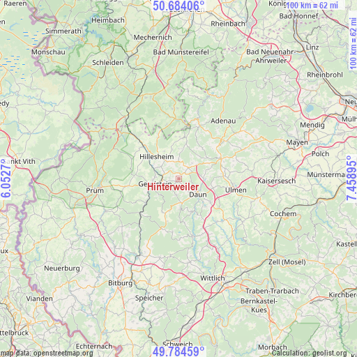
Hinterweiler GPS coordinates[2]
50° 14' 11.22" North, 6° 45' 20.952" East
| Map corner | latitude | longitude |
|---|---|---|
| Upper-left | 50.68406°, | 6.0527° |
| Center: | 50.23645°, | 6.75582° |
| Lower-right: | 49.78459°, | 7.45895° |
| Map W x H: | 100×100 km | = 62.1×62.1mi |
| max Lat: | 55.01917° ⇑58.2% North |
| Hinterweiler: | 50.23645° |
| min Lat: | ⇓41.8% South 47.40724° |
| min Long | Hinterweiler | max Long |
| 5.92978° | 6.75582° | 14.98853° |
| W 4%⇐ | ⇒96% E |
Elevation
Elevation of Hinterweiler is 544 m = 1785 ft, and this is 294.9 m = 968 ft above average elevation for this country.
| Max E: |
1256 m = 4121 ft | 7.9% |
| Hinterweiler | 544 m 1785 ft | |
| Avg. | 249.1 m = 817 ft | |
Min E: |
-5 m = -16 ft | 92.1% |
See also: Germany elevation on elevation.city.
Geographical zone
Hinterweiler is located in North temperate zone (between Tropic of Cancer and the Arctic Circle). Distance of this North polar circle is 1815.4 km =1128 mi to North.| Distance of | km | miles | from Hinterweiler |
|---|---|---|---|
| North Pole | 4421.3 | 2747.3 | to North |
| Arctic Circle | 1815.4 | 1128 | to North |
| Tropic Cancer | 2979.9 | 1851.6 | to South |
| Equator | 5585.8 | 3470.9 | to South |


Nearby cities:
15 places around Hinterweiler: (largest is in red/bold)
• Berlingen
2.6 km =1.6 mi,  276°
276°
• Betteldorf
1.6 km =1 mi,  344°
344°
• Daun
6.8 km =4.2 mi,  129°
129°
• Dockweiler
2.5 km =1.6 mi,  52°
52°
• Dreis-Brück
4.2 km =2.6 mi,  38°
38°
• Gerolstein
7 km =4.3 mi,  256°
256°
• Hohenfels-Essingen
2.2 km =1.4 mi,  313°
313°
• Kirchweiler
1 km =0.6 mi,  227°
227°
• Kradenbach
6.9 km =4.3 mi,  77°
77°
• Neroth
4.5 km =2.8 mi,  188°
188°
• Oberehe-Stroheich
5.3 km =3.3 mi,  8°
8°
• Oberstadtfeld
6.8 km =4.2 mi,  171°
171°
• Pelm
4.7 km =2.9 mi, 263°
• Rockeskyll
4.2 km =2.6 mi,  290°
290°
• Walsdorf
5.9 km =3.7 mi,  331°
331°
Sources, notices
• [Note1] Compared only with cities in Germany existing in our database
• [Src1] Map data: © OpenStreetMap contributors (CC-BY-SA)
• [Src2] Other city data from geonames.org with taken over terms of usage.
• [Src3] Geographical zone / Annual Mean Temperature by Robert A. Rohde @ Wikipedia
