Vollstedt geodata
Vollstedt (Schleswig-Holstein) is a seat of a fourth-order administrative division; located in Germany in Europe/Berlin (GMT+2) time zone. With population of 162 people, there are 10632 cities with bigger population in this country. Compared to other cities in Germany, 98.6% of cities are located further ↓South; 65% of cities are located further →East and 90.1% of cities have higher elevation than Vollstedt. Note1
Administrative division(s):
- Level 1: Schleswig-Holstein
- Level 3: Kreis Nordfriesland
- Level 4: Vollstedt


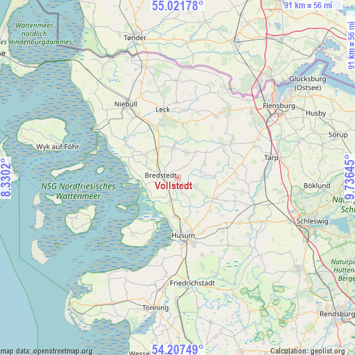
Vollstedt GPS coordinates[2]
54° 37' 0.012" North, 9° 1' 59.988" East
| Map corner | latitude | longitude |
|---|---|---|
| Upper-left | 55.02178°, | 8.3302° |
| Center: | 54.61667°, | 9.03333° |
| Lower-right: | 54.20749°, | 9.73645° |
| Map W x H: | 90.5×90.5 km | = 56.2×56.2mi |
| max Lat: | 55.01917° ⇑1.4% North |
| Vollstedt: | 54.61667° |
| min Lat: | ⇓98.6% South 47.40724° |
| min Long | Vollstedt | max Long |
| 5.92978° | 9.03333° | 14.98853° |
| W 35%⇐ | ⇒65% E |
Elevation
Elevation of Vollstedt is 21 m = 69 ft, and this is 228.1 m = 748 ft below average elevation for this country.
| Max E: |
1256 m = 4121 ft | 90.1% |
| Avg. | 249.1 m = 817 ft | |
| Vollstedt | 21 m = 69 ft | |
Min E: |
-5 m = -16 ft | 9.9% |
See also: Germany elevation on elevation.city.
Geographical zone
Vollstedt is located in North temperate zone (between Tropic of Cancer and the Arctic Circle). Distance of this North polar circle is 1328.4 km =825.4 mi to North.| Distance of | km | miles | from Vollstedt |
|---|---|---|---|
| North Pole | 3934.3 | 2444.7 | to North |
| Arctic Circle | 1328.4 | 825.4 | to North |
| Tropic Cancer | 3466.9 | 2154.2 | to South |
| Equator | 6072.8 | 3773.5 | to South |


Nearby cities:
15 places around Vollstedt: (largest is in red/bold)
• Ahrenshöft
7.7 km =4.8 mi,  163°
163°
• Almdorf
3.9 km =2.4 mi,  196°
196°
• Bohmstedt
3.9 km =2.4 mi, 163°
• Bordelum
6.7 km =4.2 mi,  286°
286°
• Bredstedt
4.4 km =2.7 mi,  272°
272°
• Breklum
3.7 km =2.3 mi,  240°
240°
• Drelsdorf
1.4 km =0.9 mi,  149°
149°
• Hattstedtermarsch
7.7 km =4.8 mi, 196°
• Högel
4.3 km =2.7 mi,  30°
30°
• Joldelund
7.4 km =4.6 mi,  60°
60°
• Kolkerheide
6.4 km =4 mi,  90°
90°
• Lütjenholm
7.5 km =4.7 mi,  351°
351°
• Norstedt
7.4 km =4.6 mi,  119°
119°
• Struckum
4.3 km =2.7 mi,  210°
210°
• Sönnebüll
2.8 km =1.7 mi,  310°
310°
Sources, notices
• [Note1] Compared only with cities in Germany existing in our database
• [Src1] Map data: © OpenStreetMap contributors (CC-BY-SA)
• [Src2] Other city data from geonames.org with taken over terms of usage.
• [Src3] Geographical zone / Annual Mean Temperature by Robert A. Rohde @ Wikipedia
