Talkau geodata
Talkau (Schleswig-Holstein) is a seat of a fourth-order administrative division; located in Germany in Europe/Berlin (GMT+2) time zone. With population of 543 people, there are 9125 cities with bigger population in this country. Compared to other cities in Germany, 86.6% of cities are located further ↓South; 60.2% of cities are located further ←West and 74.7% of cities have higher elevation than Talkau. Note1
Administrative division(s):
- Level 1: Schleswig-Holstein
- Level 3: Kreis Herzogtum Lauenburg
- Level 4: Talkau


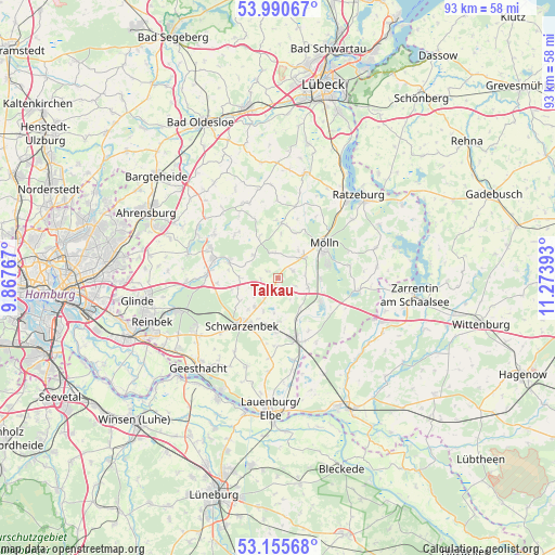
Talkau GPS coordinates[2]
53° 34' 30.864" North, 10° 34' 14.88" East
| Map corner | latitude | longitude |
|---|---|---|
| Upper-left | 53.99067°, | 9.86767° |
| Center: | 53.57524°, | 10.5708° |
| Lower-right: | 53.15568°, | 11.27393° |
| Map W x H: | 92.8×92.8 km | = 57.7×57.7mi |
| max Lat: | 55.01917° ⇑13.4% North |
| Talkau: | 53.57524° |
| min Lat: | ⇓86.6% South 47.40724° |
| min Long | Talkau | max Long |
| 5.92978° | 10.5708° | 14.98853° |
| W 60.2%⇐ | ⇒39.8% E |
Elevation
Elevation of Talkau is 64 m = 210 ft, and this is 185.1 m = 607 ft below average elevation for this country.
| Max E: |
1256 m = 4121 ft | 74.7% |
| Avg. | 249.1 m = 817 ft | |
| Talkau | 64 m = 210 ft | |
Min E: |
-5 m = -16 ft | 25.3% |
See also: Germany elevation on elevation.city.
Geographical zone
Talkau is located in North temperate zone (between Tropic of Cancer and the Arctic Circle). Distance of this North polar circle is 1444.2 km =897.4 mi to North.| Distance of | km | miles | from Talkau |
|---|---|---|---|
| North Pole | 4050.1 | 2516.6 | to North |
| Arctic Circle | 1444.2 | 897.4 | to North |
| Tropic Cancer | 3351.1 | 2082.3 | to South |
| Equator | 5957 | 3701.5 | to South |


Nearby cities:
15 places around Talkau: (largest is in red/bold)
• Basthorst
6.4 km =4 mi,  271°
271°
• Borstorf
4.6 km =2.9 mi,  356°
356°
• Breitenfelde
5.4 km =3.4 mi,  50°
50°
• Bälau
5.5 km =3.4 mi,  33°
33°
• Elmenhorst
4 km =2.5 mi,  215°
215°
• Fuhlenhagen
2.8 km =1.7 mi,  264°
264°
• Groß Pampau
5.9 km =3.7 mi,  185°
185°
• Hornbek
4.2 km =2.6 mi,  102°
102°
• Kankelau
2.8 km =1.7 mi, 185°
• Klein Schretstaken
1.2 km =0.7 mi,  0°
0°
• Mühlenrade
6 km =3.7 mi,  293°
293°
• Roseburg
6.2 km =3.9 mi,  143°
143°
• Sahms
6.1 km =3.8 mi,  204°
204°
• Tramm
3 km =1.9 mi,  113°
113°
• Woltersdorf
4.8 km =3 mi,  93°
93°
Sources, notices
• [Note1] Compared only with cities in Germany existing in our database
• [Src1] Map data: © OpenStreetMap contributors (CC-BY-SA)
• [Src2] Other city data from geonames.org with taken over terms of usage.
• [Src3] Geographical zone / Annual Mean Temperature by Robert A. Rohde @ Wikipedia
