Straach geodata
Straach (Saxony-Anhalt) is a populated place; located in Germany in Europe/Berlin (GMT+2) time zone. With population of 934 people, there are 7407 cities with bigger population in this country. Compared to other cities in Germany, 71.7% of cities are located further ↓South; 88.8% of cities are located further ←West and 64.1% of cities have higher elevation than Straach. Note1
Administrative division(s):
- Level 1: Saxony-Anhalt
- Level 3: Landkreis Wittenberg
- Level 4: Wittenberg, Lutherstadt


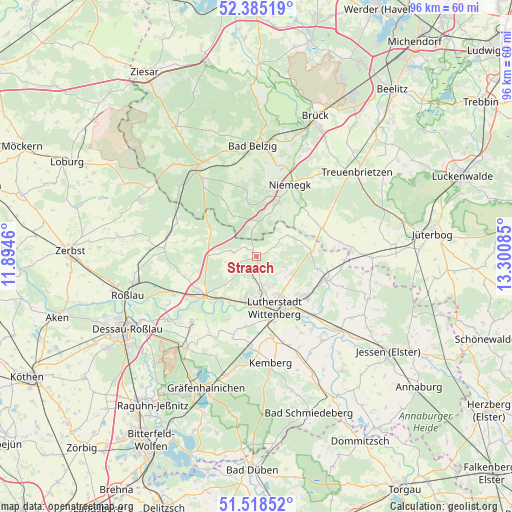
Straach GPS coordinates[2]
51° 57' 14.22" North, 12° 35' 51.792" East
| Map corner | latitude | longitude |
|---|---|---|
| Upper-left | 52.38519°, | 11.8946° |
| Center: | 51.95395°, | 12.59772° |
| Lower-right: | 51.51852°, | 13.30085° |
| Map W x H: | 96.4×96.4 km | = 59.9×59.9mi |
| max Lat: | 55.01917° ⇑28.3% North |
| Straach: | 51.95395° |
| min Lat: | ⇓71.7% South 47.40724° |
| min Long | Straach | max Long |
| 5.92978° | 12.59772° | 14.98853° |
| W 88.8%⇐ | ⇒11.2% E |
Elevation
Elevation of Straach is 126 m = 413 ft, and this is 123.1 m = 404 ft below average elevation for this country.
| Max E: |
1256 m = 4121 ft | 64.1% |
| Avg. | 249.1 m = 817 ft | |
| Straach | 126 m = 413 ft | |
Min E: |
-5 m = -16 ft | 35.9% |
See also: Germany elevation on elevation.city.
Geographical zone
Straach is located in North temperate zone (between Tropic of Cancer and the Arctic Circle). Distance of this North polar circle is 1624.4 km =1009.4 mi to North.| Distance of | km | miles | from Straach |
|---|---|---|---|
| North Pole | 4230.3 | 2628.6 | to North |
| Arctic Circle | 1624.4 | 1009.4 | to North |
| Tropic Cancer | 3170.8 | 1970.2 | to South |
| Equator | 5776.7 | 3589.5 | to South |


Nearby cities:
15 places around Straach: (largest is in red/bold)
• Apollensdorf
9.2 km =5.7 mi,  200°
200°
• Apollensdorf-Nord
7.4 km =4.6 mi,  194°
194°
• Boßdorf
7.1 km =4.4 mi,  56°
56°
• Cobbelsdorf
4.7 km =2.9 mi,  279°
279°
• Dobien
5.5 km =3.4 mi,  170°
170°
• Friedrichstadt
8.9 km =5.5 mi,  146°
146°
• Griebo
10.1 km =6.3 mi,  217°
217°
• Kleinwittenberg
9.8 km =6.1 mi, 173°
• Kropstädt
10.2 km =6.3 mi,  84°
84°
• Mochau
6.2 km =3.9 mi,  114°
114°
• Nudersdorf
2.6 km =1.6 mi,  183°
183°
• Piesteritz
9.4 km =5.8 mi, 179°
• Reinsdorf
6.7 km =4.2 mi, 176°
• Rothemark
8.2 km =5.1 mi, 170°
• Teuchel
8 km =5 mi,  155°
155°
Sources, notices
• [Note1] Compared only with cities in Germany existing in our database
• [Src1] Map data: © OpenStreetMap contributors (CC-BY-SA)
• [Src2] Other city data from geonames.org with taken over terms of usage.
• [Src3] Geographical zone / Annual Mean Temperature by Robert A. Rohde @ Wikipedia
