Kropstädt geodata
Kropstädt (Saxony-Anhalt) is a populated place; located in Germany in Europe/Berlin (GMT+2) time zone. With population of 1,364 people, there are 6154 cities with bigger population in this country. Compared to other cities in Germany, 71.8% of cities are located further ↓South; 90.2% of cities are located further ←West and 67% of cities have higher elevation than Kropstädt. Note1
Administrative division(s):
- Level 1: Saxony-Anhalt
- Level 3: Landkreis Wittenberg
- Level 4: Wittenberg, Lutherstadt


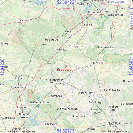
Kropstädt GPS coordinates[2]
51° 57' 47.052" North, 12° 44' 43.8" East
| Map corner | latitude | longitude |
|---|---|---|
| Upper-left | 52.39422°, | 12.04238° |
| Center: | 51.96307°, | 12.7455° |
| Lower-right: | 51.52773°, | 13.44863° |
| Map W x H: | 96.3×96.3 km | = 59.8×59.8mi |
| max Lat: | 55.01917° ⇑28.2% North |
| Kropstädt: | 51.96307° |
| min Lat: | ⇓71.8% South 47.40724° |
| min Long | Kropstädt | max Long |
| 5.92978° | 12.7455° | 14.98853° |
| W 90.2%⇐ | ⇒9.8% E |
Elevation
Elevation of Kropstädt is 108 m = 354 ft, and this is 141.1 m = 463 ft below average elevation for this country.
| Max E: |
1256 m = 4121 ft | 67% |
| Avg. | 249.1 m = 817 ft | |
| Kropstädt | 108 m = 354 ft | |
Min E: |
-5 m = -16 ft | 33% |
See also: Germany elevation on elevation.city.
Geographical zone
Kropstädt is located in North temperate zone (between Tropic of Cancer and the Arctic Circle). Distance of this North polar circle is 1623.4 km =1008.7 mi to North.| Distance of | km | miles | from Kropstädt |
|---|---|---|---|
| North Pole | 4229.3 | 2628 | to North |
| Arctic Circle | 1623.4 | 1008.7 | to North |
| Tropic Cancer | 3171.8 | 1970.9 | to South |
| Equator | 5777.8 | 3590.2 | to South |


Nearby cities:
15 places around Kropstädt: (largest is in red/bold)
• Abtsdorf
8.3 km =5.2 mi,  189°
189°
• Boßdorf
5 km =3.1 mi,  304°
304°
• Bülzig
7.7 km =4.8 mi,  174°
174°
• Dobien
11.3 km =7 mi,  235°
235°
• Elstervorstadt
11.6 km =7.2 mi,  198°
198°
• Friedrichstadt
9.9 km =6.2 mi,  211°
211°
• Mochau
5.8 km =3.6 mi,  231°
231°
• Mühlanger
12.6 km =7.8 mi,  178°
178°
• Nudersdorf
10.9 km =6.8 mi,  250°
250°
• Reinsdorf
12.4 km =7.7 mi, 231°
• Straach
10.2 km =6.3 mi,  264°
264°
• Teuchel
10.8 km =6.7 mi,  219°
219°
• Wittenberg
12.6 km =7.8 mi, 211°
• Zahna
6.1 km =3.8 mi,  153°
153°
• Zörnigall
10.4 km =6.5 mi, 176°
Sources, notices
• [Note1] Compared only with cities in Germany existing in our database
• [Src1] Map data: © OpenStreetMap contributors (CC-BY-SA)
• [Src2] Other city data from geonames.org with taken over terms of usage.
• [Src3] Geographical zone / Annual Mean Temperature by Robert A. Rohde @ Wikipedia
