Sinspelt geodata
Sinspelt (Rheinland-Pfalz) is a seat of a fourth-order administrative division; located in Germany in Europe/Berlin (GMT+2) time zone. With population of 451 people, there are 9535 cities with bigger population in this country. Compared to other cities in Germany, 64.5% of cities are located further ↑North; 99% of cities are located further →East and 61.3% of cities have lower elevation than Sinspelt. Note1
Administrative division(s):
- Level 1: Rheinland-Pfalz
- Level 3: Eifelkreis Bitburg-Prüm
- Level 4: Sinspelt


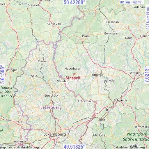
Sinspelt GPS coordinates[2]
49° 58' 21.324" North, 6° 19' 5.412" East
| Map corner | latitude | longitude |
|---|---|---|
| Upper-left | 50.42268°, | 5.61505° |
| Center: | 49.97259°, | 6.31817° |
| Lower-right: | 49.51825°, | 7.0213° |
| Map W x H: | 100.6×100.6 km | = 62.5×62.5mi |
| max Lat: | 55.01917° ⇑64.5% North |
| Sinspelt: | 49.97259° |
| min Lat: | ⇓35.5% South 47.40724° |
| min Long | Sinspelt | max Long |
| 5.92978° | 6.31817° | 14.98853° |
| W 1%⇐ | ⇒99% E |
Elevation
Elevation of Sinspelt is 298 m = 978 ft, and this is 48.9 m = 160 ft above average elevation for this country.
| Max E: |
1256 m = 4121 ft | 38.7% |
| Sinspelt | 298 m 978 ft | |
| Avg. | 249.1 m = 817 ft | |
Min E: |
-5 m = -16 ft | 61.3% |
See also: Germany elevation on elevation.city.
Geographical zone
Sinspelt is located in North temperate zone (between Tropic of Cancer and the Arctic Circle). Distance of this North polar circle is 1844.7 km =1146.2 mi to North.| Distance of | km | miles | from Sinspelt |
|---|---|---|---|
| North Pole | 4450.6 | 2765.5 | to North |
| Arctic Circle | 1844.7 | 1146.2 | to North |
| Tropic Cancer | 2950.5 | 1833.4 | to South |
| Equator | 5556.4 | 3452.6 | to South |


Nearby cities:
15 places around Sinspelt: (largest is in red/bold)
• Brimingen
3.3 km =2.1 mi,  95°
95°
• Burg
2.4 km =1.5 mi,  106°
106°
• Fischbach-Oberraden
3.2 km =2 mi,  19°
19°
• Geichlingen
4.5 km =2.8 mi,  235°
235°
• Hisel
4.1 km =2.5 mi, 104°
• Lahr
3.7 km =2.3 mi,  211°
211°
• Mettendorf
2.9 km =1.8 mi,  162°
162°
• Muxerath
3.9 km =2.4 mi,  287°
287°
• Nasingen
4.9 km =3 mi,  262°
262°
• Niedergeckler
1.5 km =0.9 mi, 243°
• Niederraden
1.2 km =0.7 mi,  354°
354°
• Niehl
3.1 km =1.9 mi,  121°
121°
• Obergeckler
1.5 km =0.9 mi, 243°
• Olsdorf
5 km =3.1 mi, 114°
• Utscheid
3.8 km =2.4 mi,  36°
36°
Sources, notices
• [Note1] Compared only with cities in Germany existing in our database
• [Src1] Map data: © OpenStreetMap contributors (CC-BY-SA)
• [Src2] Other city data from geonames.org with taken over terms of usage.
• [Src3] Geographical zone / Annual Mean Temperature by Robert A. Rohde @ Wikipedia
