Lahr geodata
Lahr (Rheinland-Pfalz) is a seat of a fourth-order administrative division; located in Germany in Europe/Berlin (GMT+2) time zone. With population of 179 people, there are 10562 cities with bigger population in this country. Compared to other cities in Germany, 65.2% of cities are located further ↑North; 99.2% of cities are located further →East and 67.7% of cities have lower elevation than Lahr. Note1


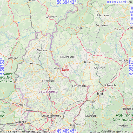
Lahr GPS coordinates[2]
49° 56' 38.616" North, 6° 17' 26.34" East
| Map corner | latitude | longitude |
|---|---|---|
| Upper-left | 50.39442°, | 5.58752° |
| Center: | 49.94406°, | 6.29065° |
| Lower-right: | 49.48945°, | 6.99377° |
| Map W x H: | 100.6×100.6 km | = 62.5×62.5mi |
| max Lat: | 55.01917° ⇑65.2% North |
| Lahr: | 49.94406° |
| min Lat: | ⇓34.8% South 47.40724° |
| min Long | Lahr | max Long |
| 5.92978° | 6.29065° | 14.98853° |
| W 0.8%⇐ | ⇒99.2% E |
Elevation
Elevation of Lahr is 341 m = 1119 ft, and this is 91.9 m = 302 ft above average elevation for this country.
| Max E: |
1256 m = 4121 ft | 32.3% |
| Lahr | 341 m 1119 ft | |
| Avg. | 249.1 m = 817 ft | |
Min E: |
-5 m = -16 ft | 67.7% |
See also: Germany elevation on elevation.city.
Geographical zone
Lahr is located in North temperate zone (between Tropic of Cancer and the Arctic Circle). Distance of this North polar circle is 1847.9 km =1148.2 mi to North.| Distance of | km | miles | from Lahr |
|---|---|---|---|
| North Pole | 4453.8 | 2767.5 | to North |
| Arctic Circle | 1847.9 | 1148.2 | to North |
| Tropic Cancer | 2947.3 | 1831.4 | to South |
| Equator | 5553.3 | 3450.7 | to South |


Nearby cities:
15 places around Lahr: (largest is in red/bold)
• Burg
4.9 km =3 mi,  59°
59°
• Geichlingen
1.8 km =1.1 mi,  291°
291°
• Halsdorf
5.6 km =3.5 mi,  102°
102°
• Hommerdingen
3.6 km =2.2 mi,  148°
148°
• Kruchten
5.2 km =3.2 mi,  159°
159°
• Körperich
3.1 km =1.9 mi,  225°
225°
• Mettendorf
2.8 km =1.7 mi,  81°
81°
• Muxerath
4.7 km =2.9 mi,  338°
338°
• Nasingen
3.8 km =2.4 mi,  310°
310°
• Niedergeckler
2.6 km =1.6 mi,  14°
14°
• Niederraden
4.7 km =2.9 mi,  23°
23°
• Niehl
4.9 km =3 mi,  71°
71°
• Nusbaum
5.2 km =3.2 mi,  125°
125°
• Obergeckler
2.6 km =1.6 mi, 14°
• Sinspelt
3.7 km =2.3 mi,  31°
31°
Sources, notices
• [Note1] Compared only with cities in Germany existing in our database
• [Src1] Map data: © OpenStreetMap contributors (CC-BY-SA)
• [Src2] Other city data from geonames.org with taken over terms of usage.
• [Src3] Geographical zone / Annual Mean Temperature by Robert A. Rohde @ Wikipedia
